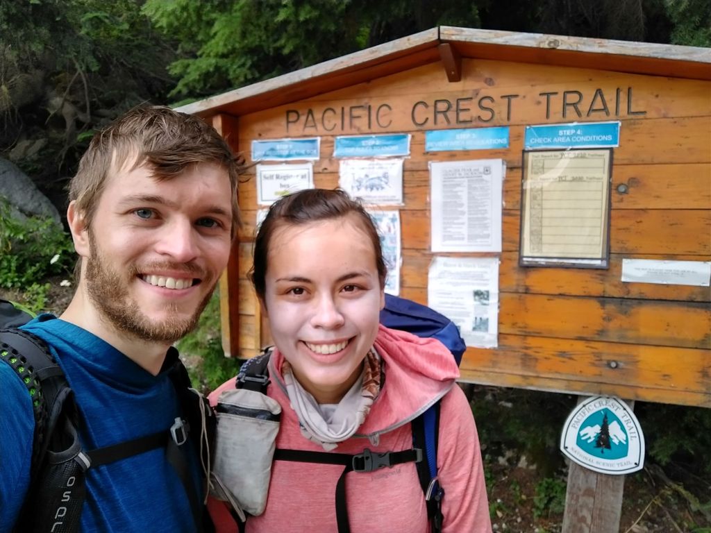
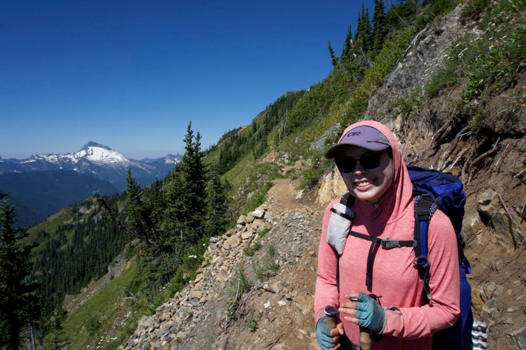
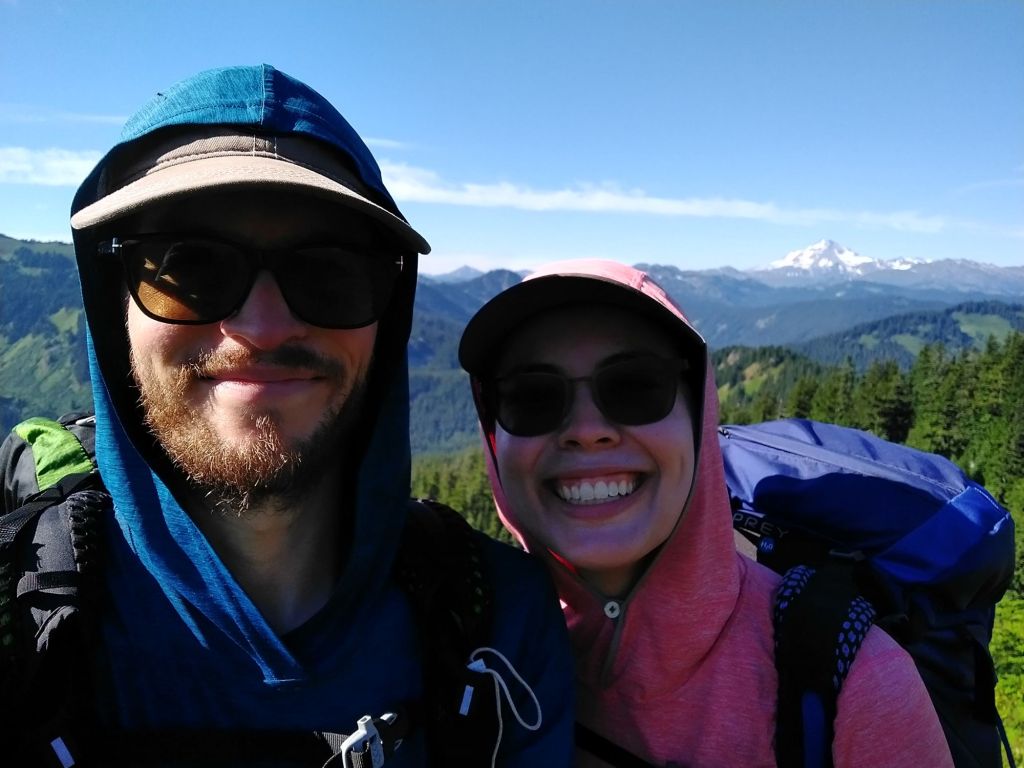
Day 19: Leaving Stehekin
- Start Mile: 2572.4
- End Mile: 2564.2
- PCT Miles: 8.2

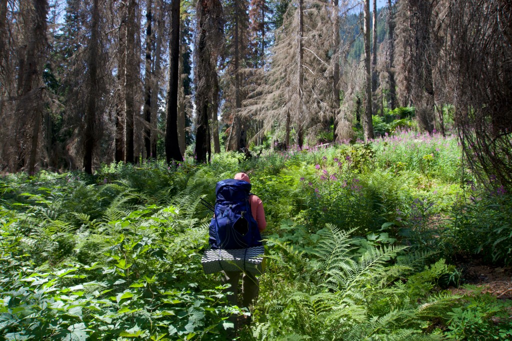
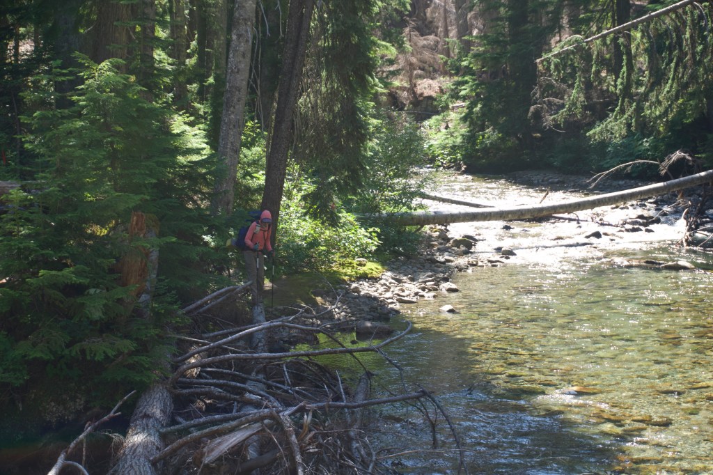
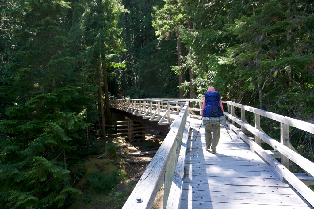
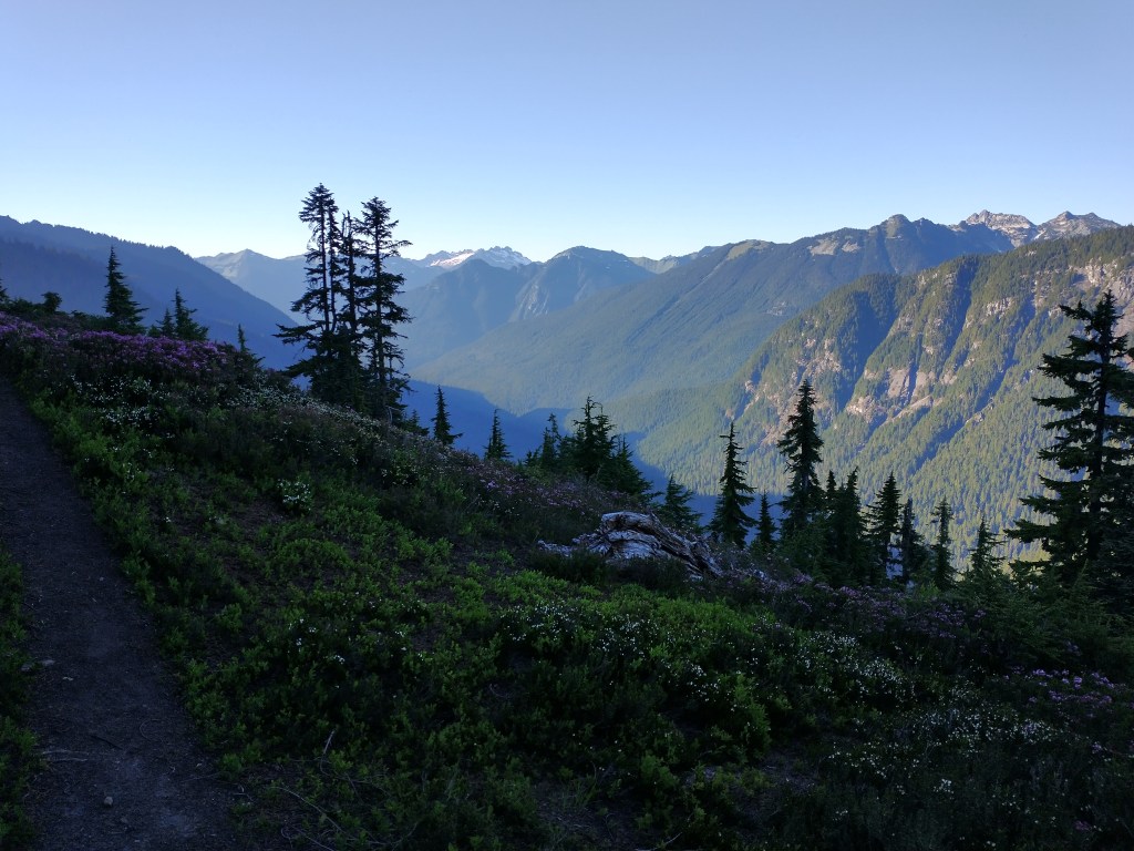
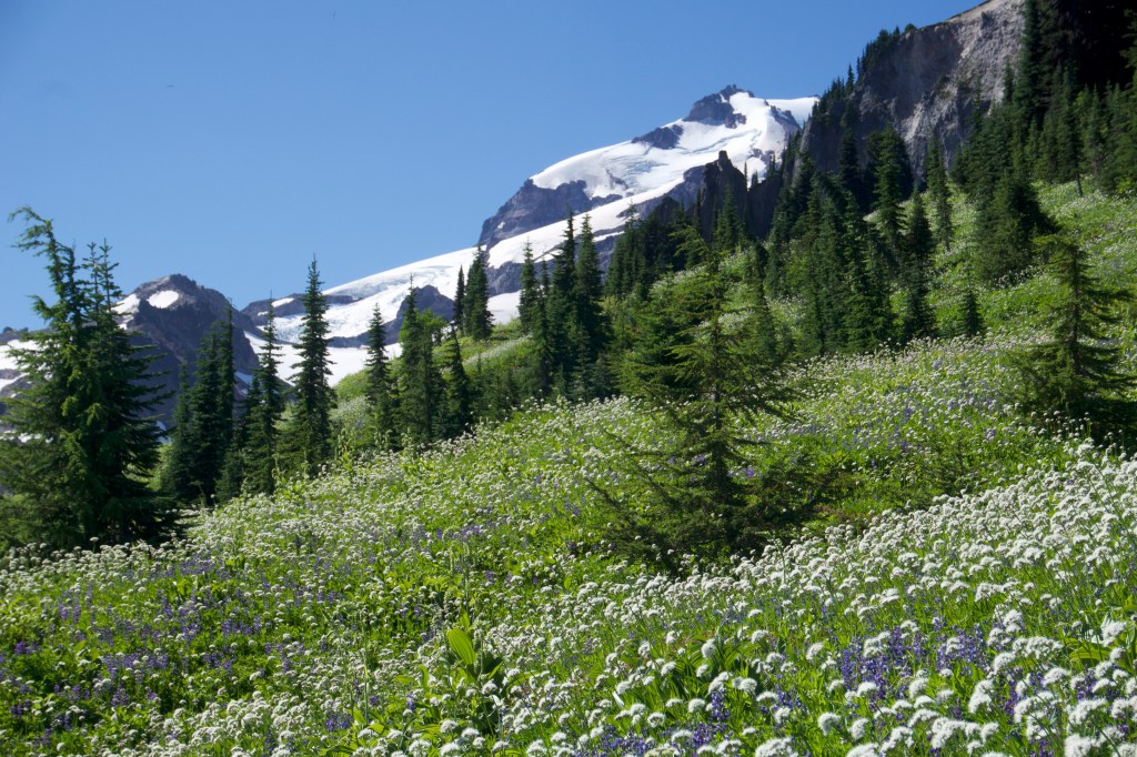
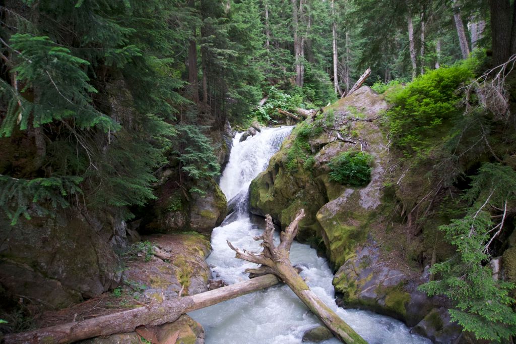
We woke up early to repack, since we had mailed ourselves way too much food (which is better than the alternative, I suppose). We decided that we would souvenir shop back at the Landing, mail our extra food back home from the post office at the Landing, stop at the Bakery for lunch, take the shuttle back to High Bridge, and get back on the trail. We got on the shuttle, which ended up including a local tour in addition to transportation to the Landing. On the way down, we stopped at Rainbow Falls (a small hike to a waterfall) and the Garden (a local organic farm with beautiful flower gardens). At the Landing, we got small gifts for all of our lovely drivers who had driven us to and from trailheads, as well as a few mementos for ourselves. We then leisurely meandered along the two mile walk from the Landing to the Bakery. It was a gorgeous day. On the way to the Bakery, we met a local who had built his own cabin out there. He told us we didn’t look like thru hikers since we weren’t emaciated enough, which was indeed a valid point.


We continued stuffing ourselves with delicious food at the Bakery. Sadly, the sandwich special was a tuna melt (which I did not find appealing), but we did manage to pack out enough food for a single day’s breakfast, lunch, and dinner on trail – plus a cinnamon roll! Tim had been unable to find any clothing that he liked at the souvenir store at the Landing, so he ended up buying two shirts and a hat at the Bakery. We didn’t have enough time to go back to the post office at the Landing, so he decided to pack them out. I told him he was carrying those all by himself for 107 miles.
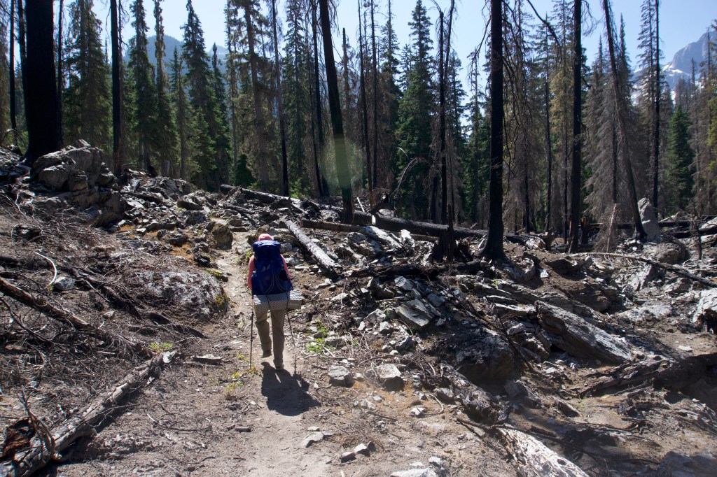
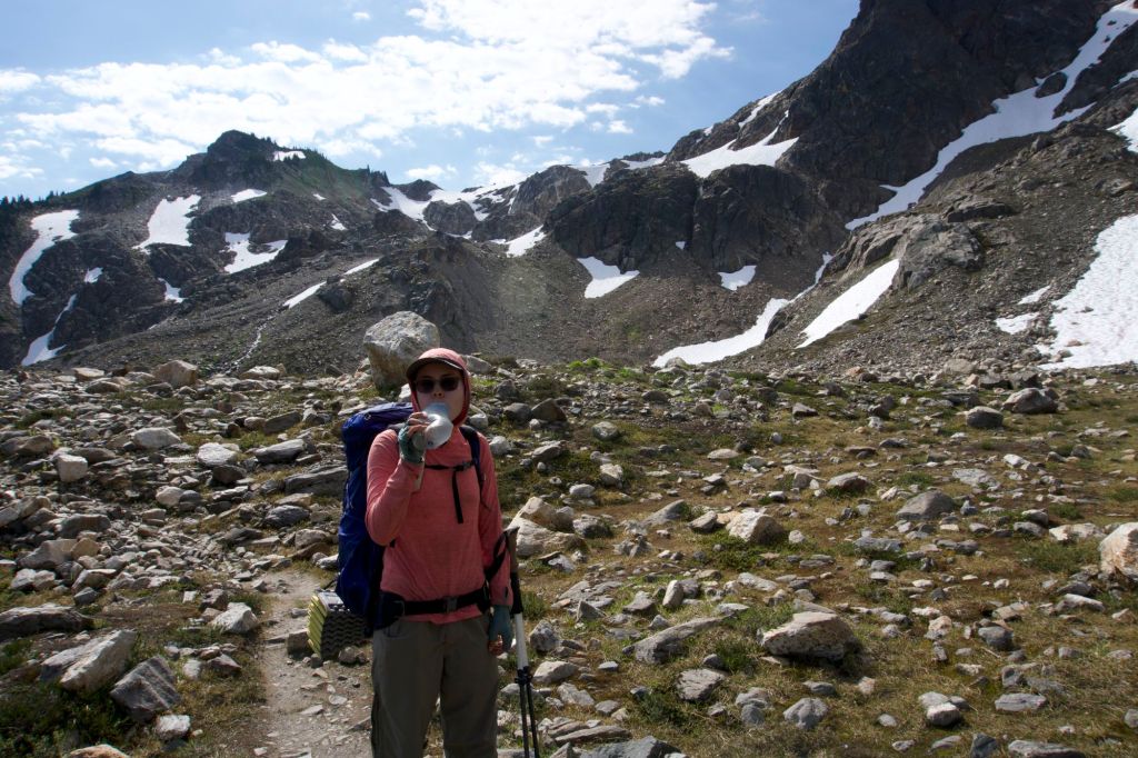
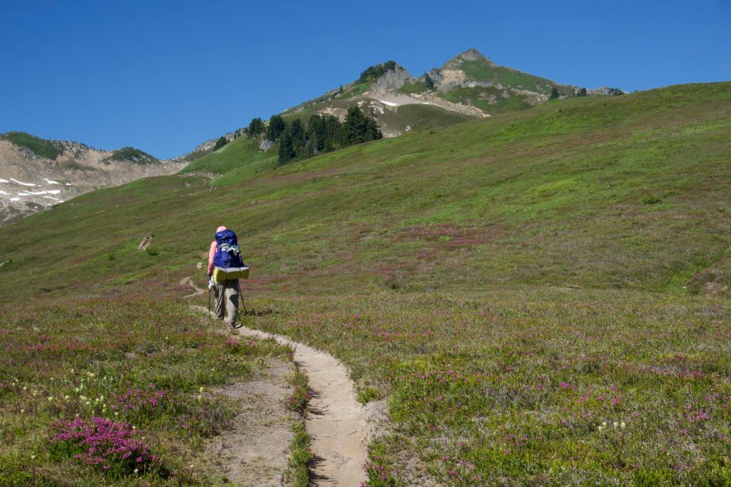
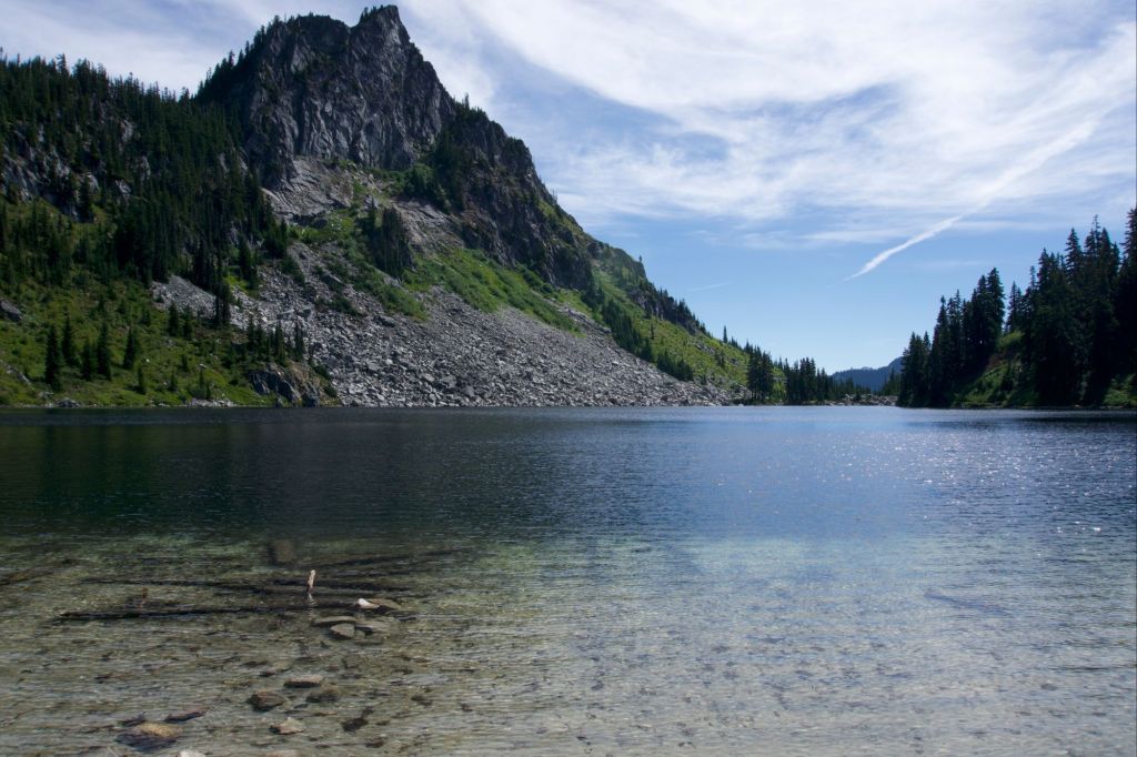
After eating, we waited for the shuttle to pick us up from the Bakery and take us to High Bridge on the PCT. This next section would be our longest without a resupply: 107.7 miles with a lot of elevation gain. We planned to complete it over the course of 8 days. My pack felt so incredibly heavy when filled with 8 days worth of food. When we got the trailhead, I found one reason for the extra weight – a White Claw that I had left in my pack! We chugged it and put it in the recycle bin (because we’re ultralight, of course).
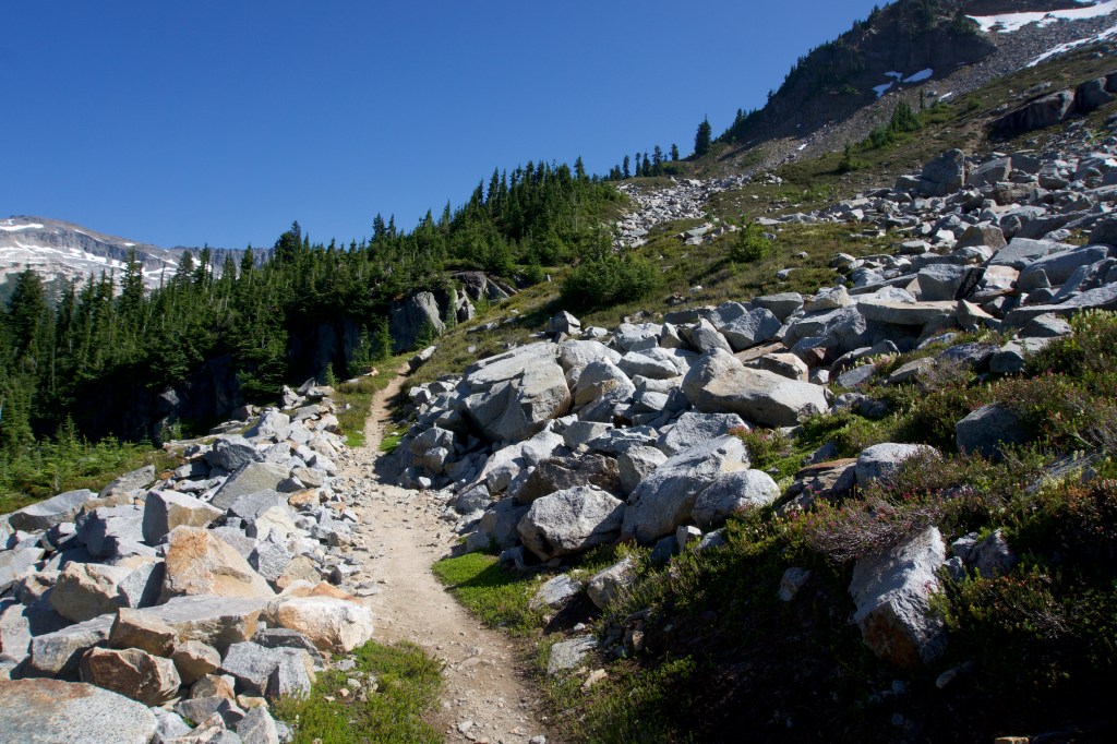
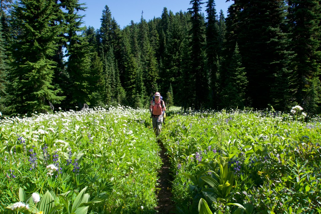
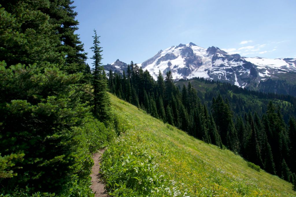
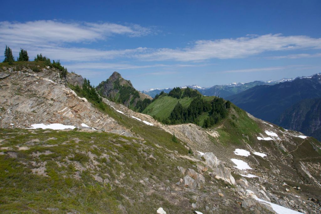
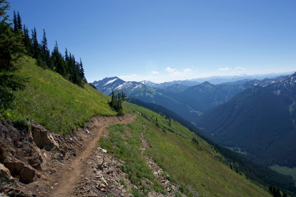
We finally started lugging ourselves and our extremely heavy packs uphill. The climb out of Stehekin is 16 miles long. Yes, you read that correctly – 16 miles of continuous uphill. Our goal for the afternoon was to hike 8 miles. It felt like the longest 8 miles ever. It was entirely uphill, our packs were enormous, and we were stuffed with food from the bakery. We finally waddled into camp at 8:40pm. We had to get our headlamps out while setting up camp, which we did efficiently and without words (I guess we’re getting better at backpacking). We ate our dinner in the tent. It was so, so worth the weight to pack out a sandwich and an oat bar from the bakery. The camp had no bugs, which was amazing. We wondered how long the lack of bugs would last.
We went to bed at 10pm, which is incredibly late by hiker standards. We are not looking forward to finishing the 16 mile climb out of Stehekin tomorrow, but at least we’re halfway through.
Day 20: The Climb
- Start Mile: 2564.2
- End Mile: 2551.5
- PCT Mileage: 12.7
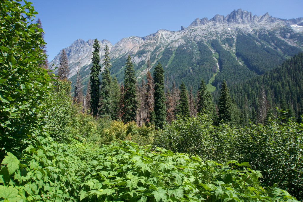


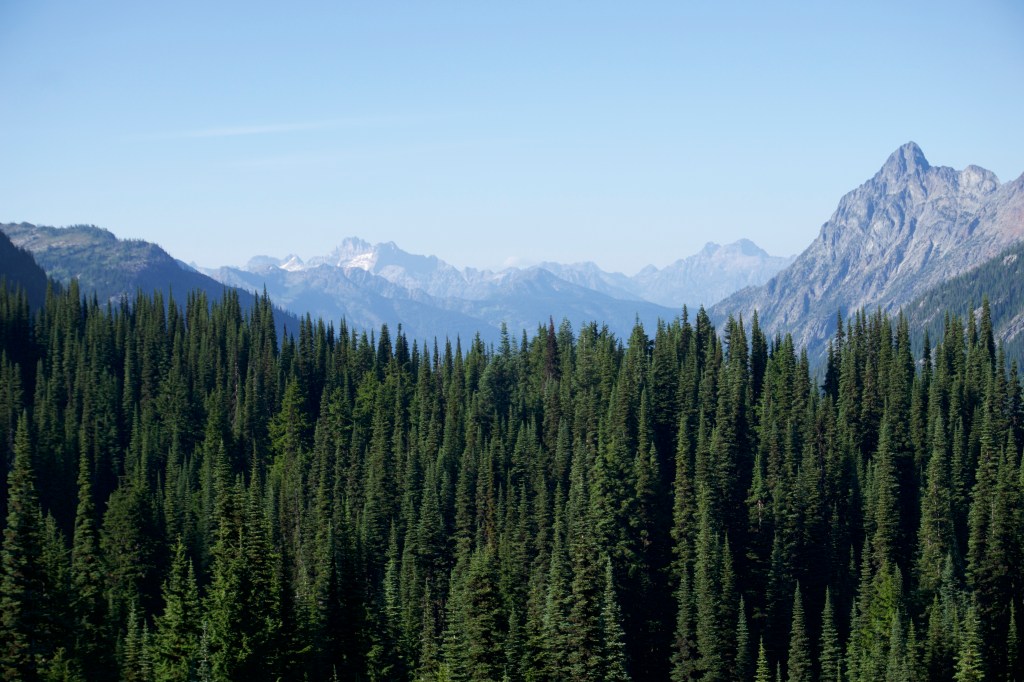
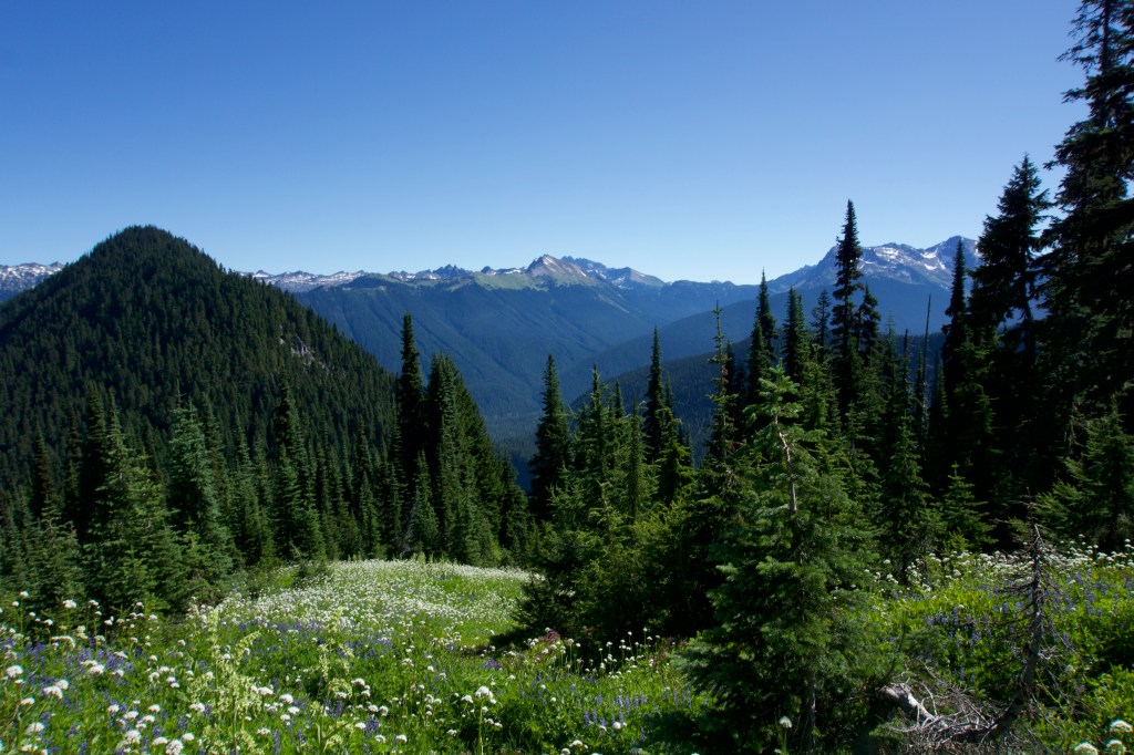
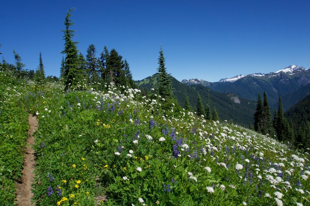
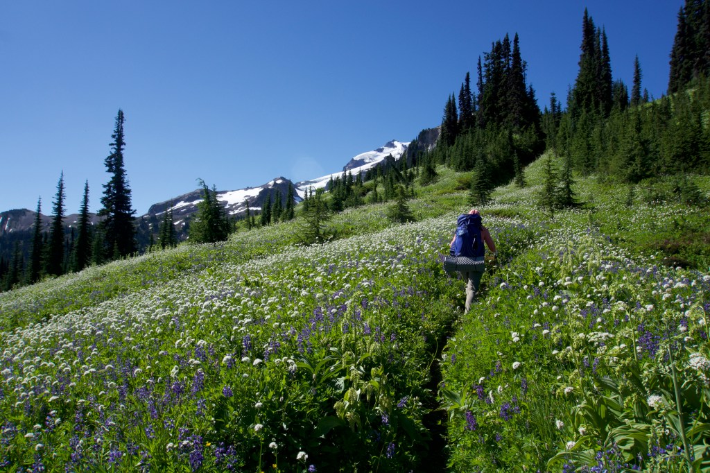
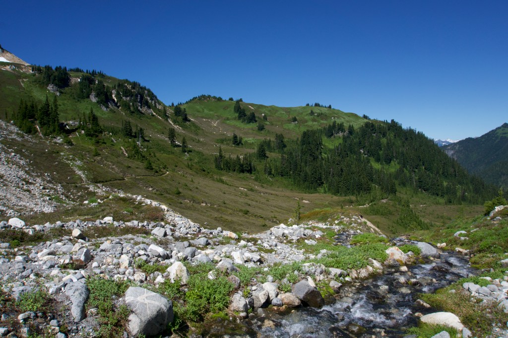
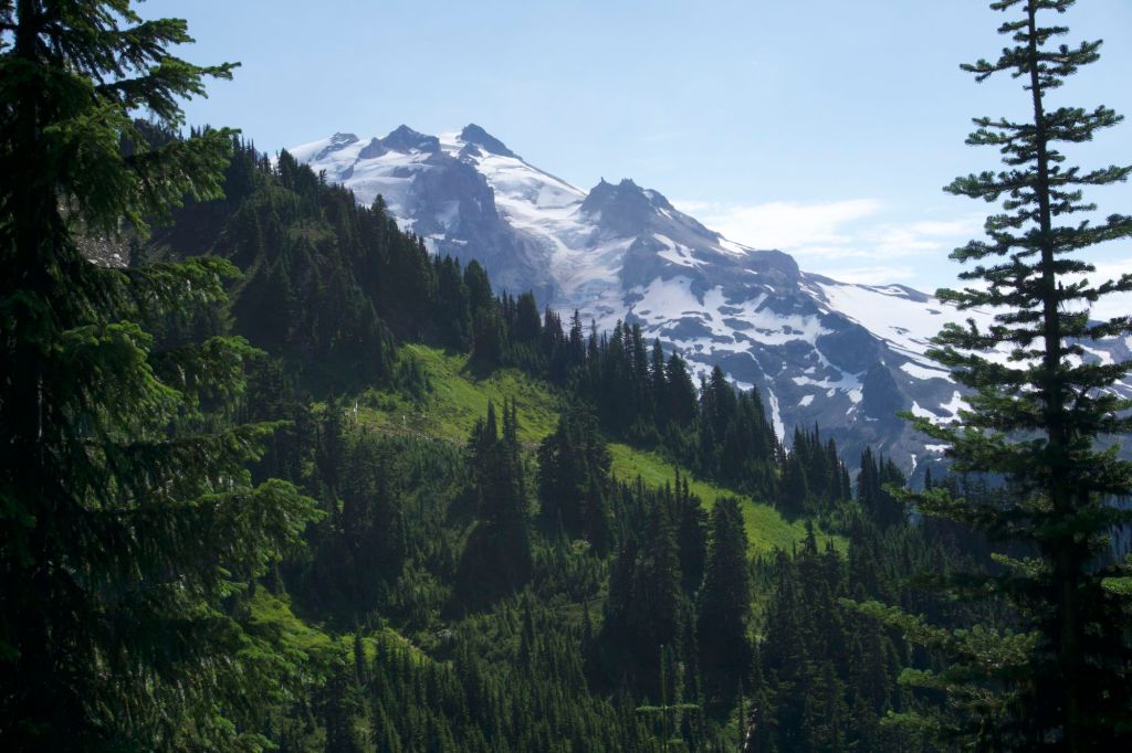
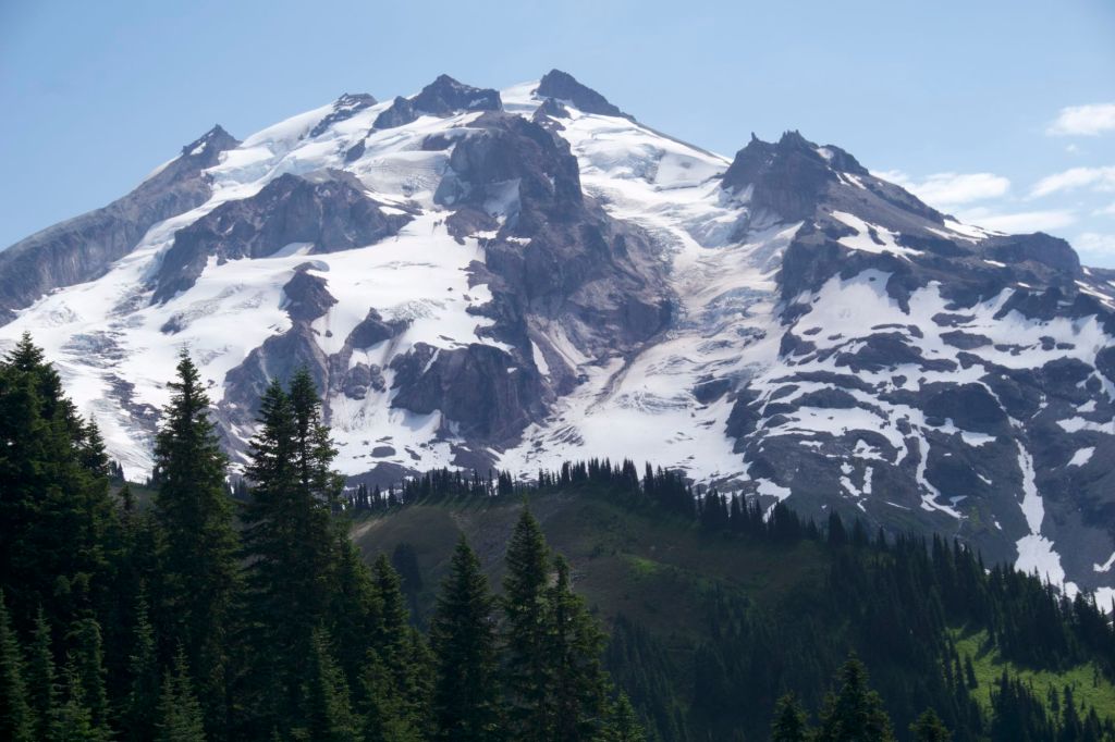
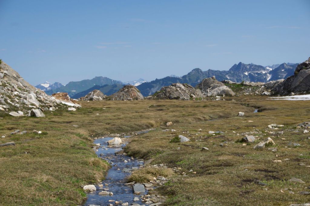
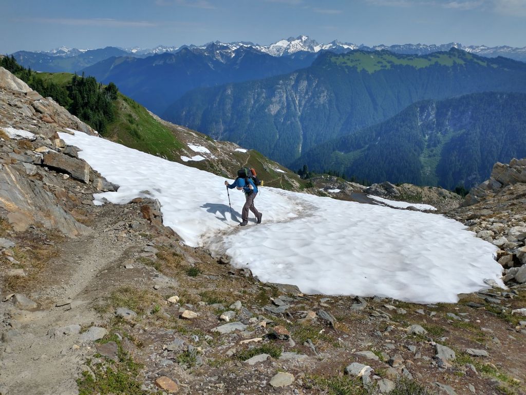
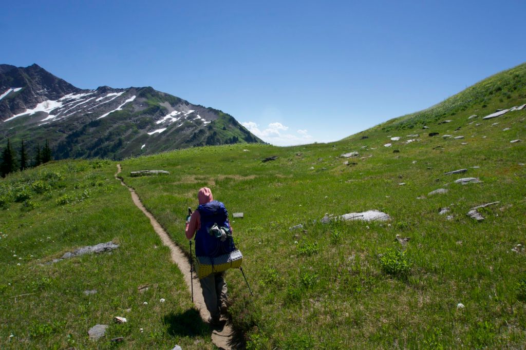
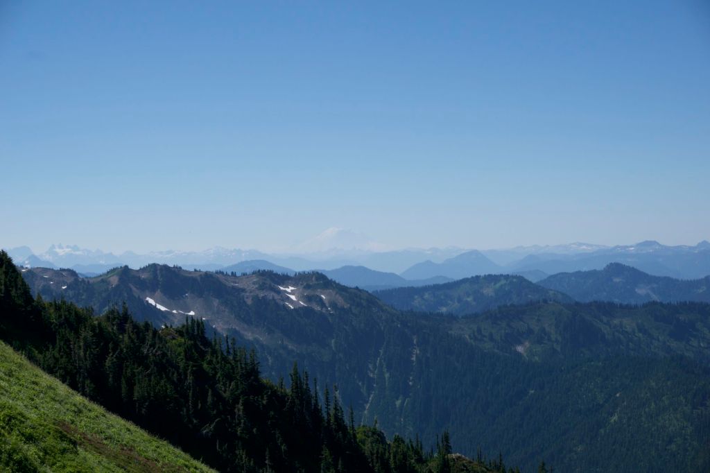
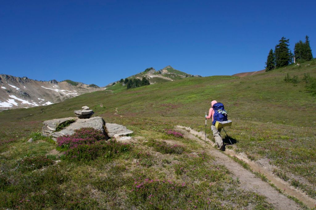
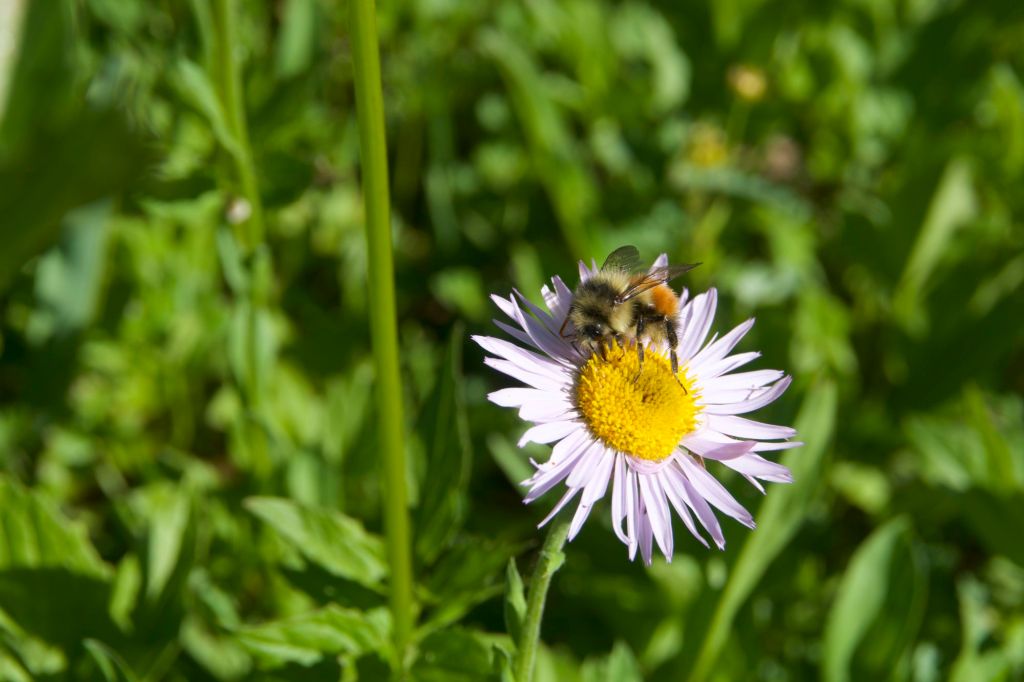
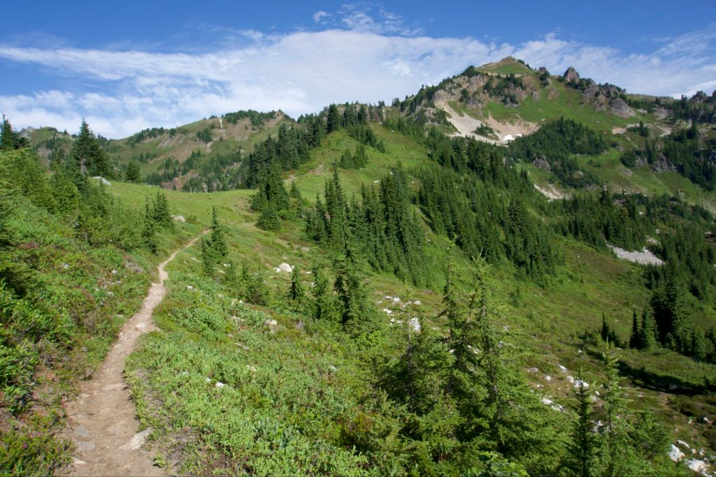
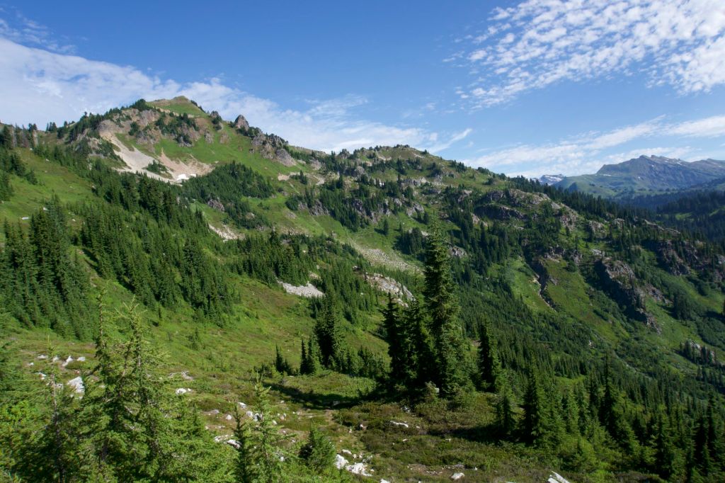
Today we were feeling slow and exhausted and didn’t get started until 10am, which is appallingly late by hiker standards. We pretty much spent the whole day climbing. At first it was somewhat boring and in the forest. There were so many huckleberries though! I dubbed this section of the trail “Huckleberry Heaven.” We gorged ourselves on the best, juiciest berries we had seen on the PCT. Finally, the climb moved out of the forest and into annoying, thick, brushy plants that covered the trail. I didn’t particularly enjoy it since it constantly seemed like we were almost about to see a view, but there were no views, and we just kept climbing up. (I’m a little spoiled from hiking in the Pacific Northwest, can you tell?) Finally, we came to a nice meadow with some views. Soon after we were back in the forest and continuing our climb. When we finally reached the top of the climb, the views were spectacular.

Tim lost his camera lens and ran a couple miles down and back to look for it, which delayed us a bit. We only did 12.7 miles today, but we had been planning on a shorter day and the elevation gain was tough. There was some historical trash at our campsite (old gas container, motor, old cabin) as well as some no-see-ums.
In my notes for this section, I described what we did as “bushwhacking”, but in hindsight that was incorrect. Section K had barely begun to teach me the true meaning of the word “bushwhacking.”
Day 21: Downhill
- Start Mile: 2551.5
- End Mile: 2535.6
- PCT Mileage: 15.9
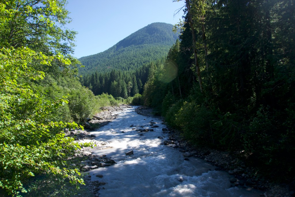
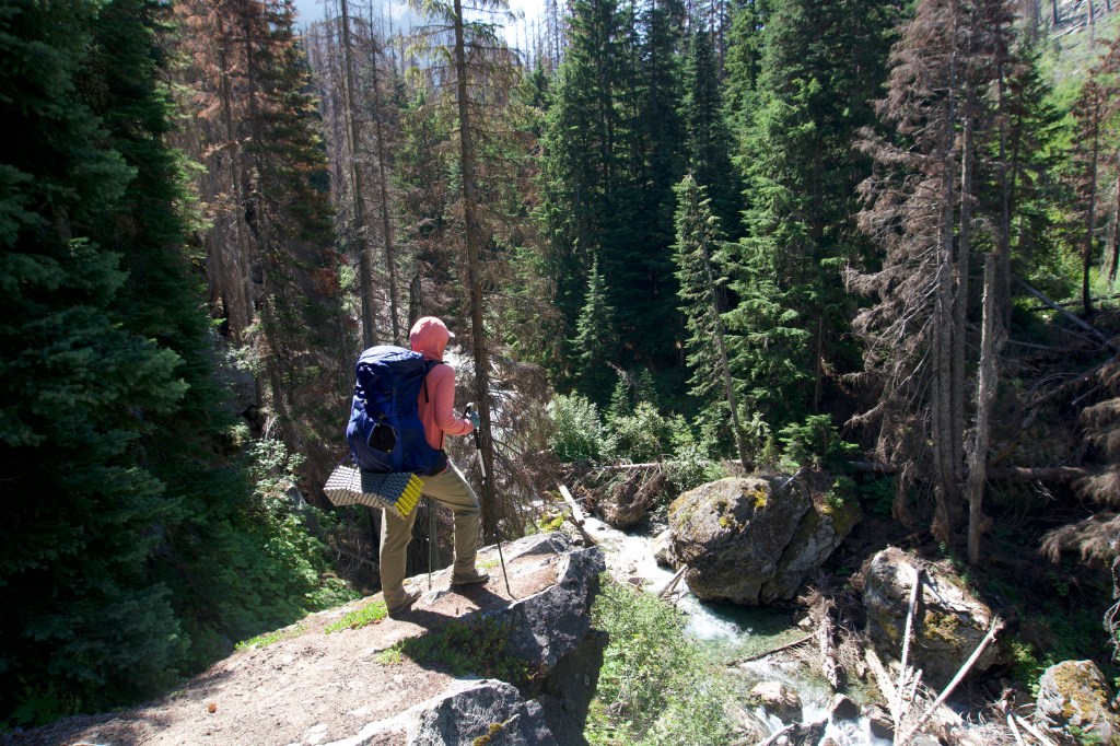
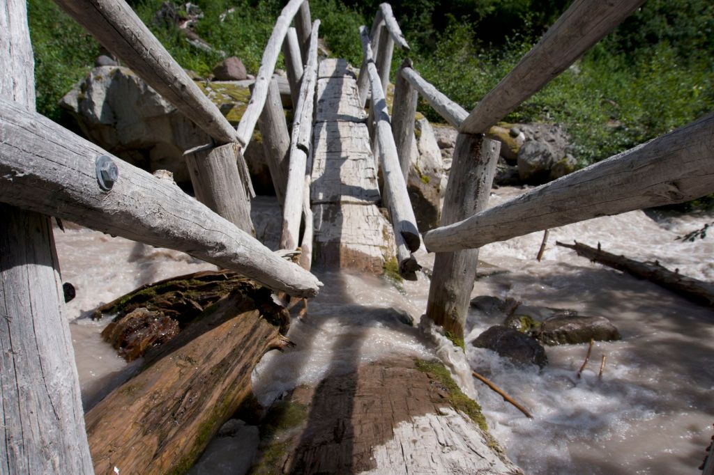
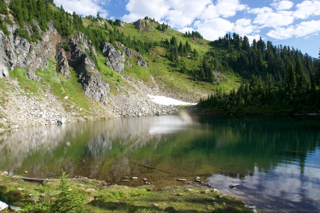
We did 15.9 miles today, but it was pretty easy. We had the most amazing 9 mile stretch of downhill. There was no brush and the elevation profile was low grade and easy on the knees. We flew through at 3 miles an hour, which was quite fast for us! We had lunch at the Suiattle River. The trail takes a several mile detour in order to use an established bridge across the river. Supposedly there’s a ford that can be used as an unofficial shortcut, but it looked impossible. I was glad we used the bridge.
Before lunch we got a little bored. We found a few trail signs that contained the inscription “Gary danger eyes!” This, of course, led us to make up a song.
Gary laser eyes / destruction in his guise / he’ll take you by surprise / and blind you with his mind
If you see Gary laser eyes / you better run and hide / before he comes to find / you with his laser eyes
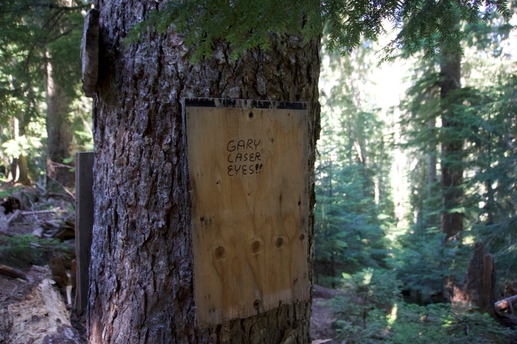
I think I’m starting to gather enough material for an album now. I’ll call it “Hiking Songs of the Pacific Northwest” and sell it at Northwest Folklife Festival.
After the river, the trail got more interesting. There were lots of huge trees and old growth. We hit a section of super hot air all of a sudden. I felt so heavy and tired and drizzled water all over myself even though we were in the shade. Luckily after about a mile we walked into cooler air – the transition was almost instantaneous. There was a climb to get to camp, but it was forested and slow grade, so we were happy and not too tired when we made it to camp.
I’m a little nervous to camp here because the Guthooks reviews say this camp is home to a large mouse community. I hope our gear survives the night! It’s not the nicest campsite, but it’s near a water source and will do. We met a neighbor A. who was hiking SOBO to Bridge of the Gods. They were doing some serious miles in this section – I was impressed.
Overall it was a pretty good day. The tincture of benzoin and leukotape I had put on my feet the day before yesterday worked really well, and my feet didn’t hurt at all. I took it off today to give it a chance to breathe. I have some other hot spots but no real blisters yet. This section is the only one that has given me foot problems so far.
Day 22: Today was a tough one
- Start Mile: 2535.6
- End Mile: 2521.8
- PCT Mileage: 13.8
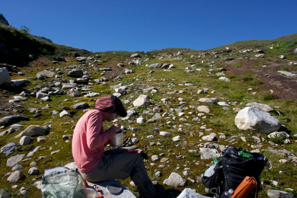
It was a rough 13.8 miles today. We woke up super late at 7am again, and decided to eat pro bars and not make any tea or coffee to save time since we had two tough climbs coming up today. Despite our time saving efforts, we finally hit the trail at 8:50am. Thankfully, if there had been any mice at our camp last night, they did not get into our gear or food. There wasn’t anywhere to properly do our business near camp, since the camp was directly next to a water source and there was no privacy. So we decided we would do our business at the next campsite 3.7 miles away, which had a highly rated toilet view on Guthooks (yes, you heard that right).
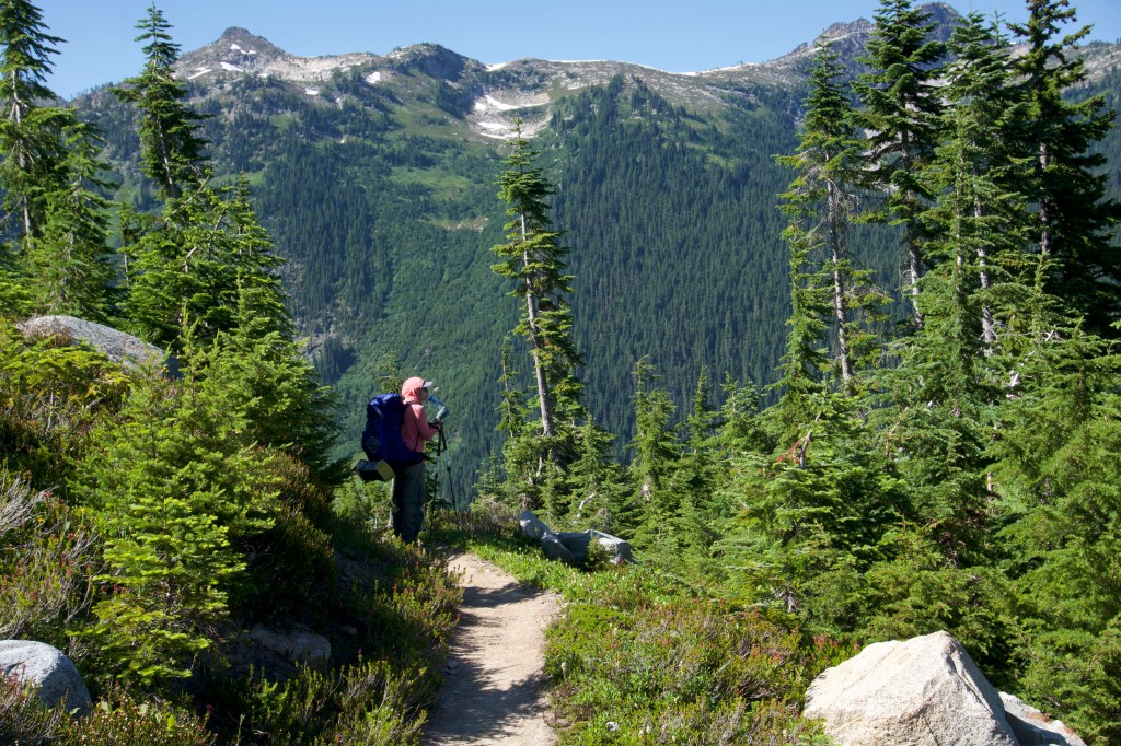
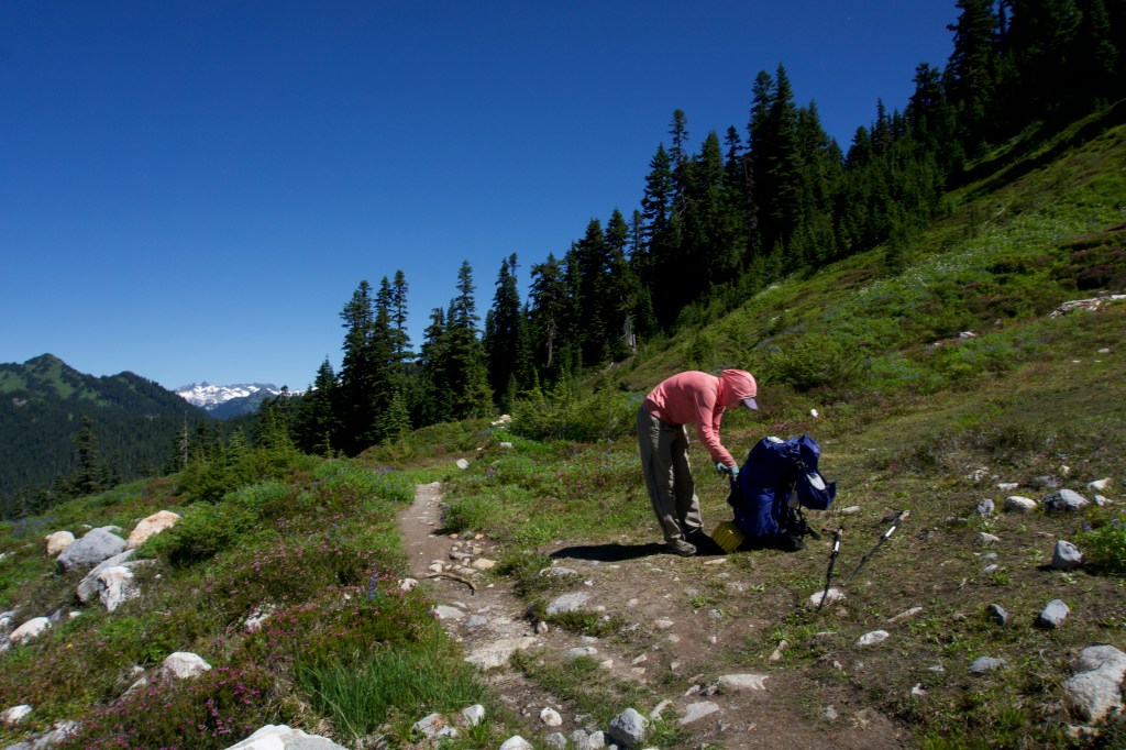
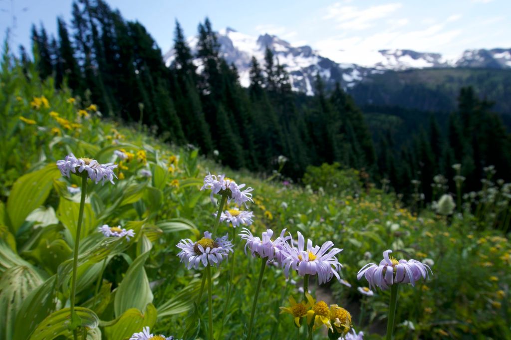
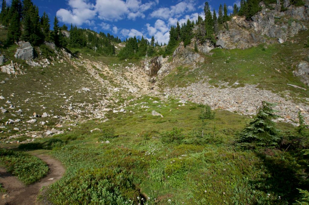
Well, the day was off to an auspicious start of 3.7 miles of never-ending switchbacks and surprise bushwhacking while desperately needing to use the toilet. Also, it was quite hot despite it being early in the day. I felt like I was going at a snail’s pace. At one point, I thought we had reached the top, but I was wrong. There was a still another top! (There’s always another top.) When we reached the actual top it was so incredibly beautiful that I thought it was almost worth it to get there. (But maybe not. If there was no way out except that horrible bushwhacking, I would be fine never seeing Section K again.) I almost cried at how beautiful it was. It was an idyllic green meadow filled with wildflowers and the most beautiful mountain views. Words and even pictures don’t do it justice. We should have taken more photos, but we were both super cranky and just wanted to get to the toilet. We finally made it, and the toilet views were indeed as incredible as advertised.

With our business done, we were feeling better and ready to continue. We went through a couple miles of idyllic alpine respite, which included horribly huge black flies the size of bumblebees, one of which bit me (of course). I pray that they are a species native to that tiny area and that they never leave to come find me again. We started on the downhill. We knew that a 7 mile section of “significant enough to complain loudly about it on Guthooks” bushwhacking was about to occur. We were lulled into a false sense of security for a mile or so. There was some brush but it wasn’t that bad. Then, the true bushwhacking started.
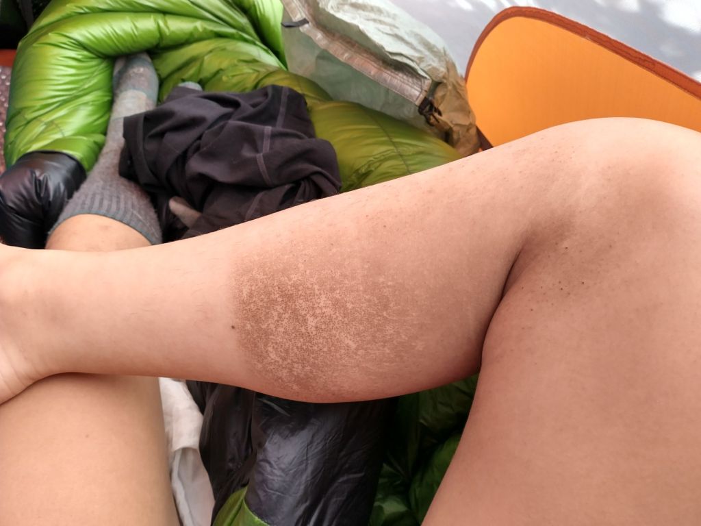
It was so horrible. I couldn’t see the trail, the trail was sideways, I was tripping over vines entangling my feet, clambering over downed trees, and trying not to fall on the giant rocks which were all over the trail. I scraped my knee and tore my pants on one such rock. Up until now my pants have survived all the crap I put them through (they survived PCT Parkour at the border). Does anyone ever maintain this section of the trail? I was getting so cranky. It was SO HOT. We were completely exposed to the sun. There was no water source on this stretch, so we were carrying 2 liters of water from the top. I dripped water all over my head at the top in an effort to cool off. We finally got near the bottom – or so I thought – and then we had to go UP. I thought I was going to die. (Not actually, just melodramatically.)

We finally got to the next water source around 3pm. We ate lunch at the bridge even though there was hardly any space to sit down and quite a few flies, but we were super hungry and wanted to sit down. We did not want to move after that, but we knew we had to keep going. I told myself, “I am ready to get hurt again.”
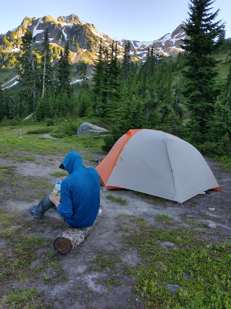
We finally rallied and started the upward climb. Blessedly, the bushwhacking only lasted for a mile or so (we were mentally prepared for three). The trail was in shade so it was cooler, it was decently graded, and I didn’t feel like I had to stare at the ground the entire time looking for hazards. We had been thinking about camping at Mica Lake, but ended up camping at the site 0.5 mile N since it was the only one with a toilet.
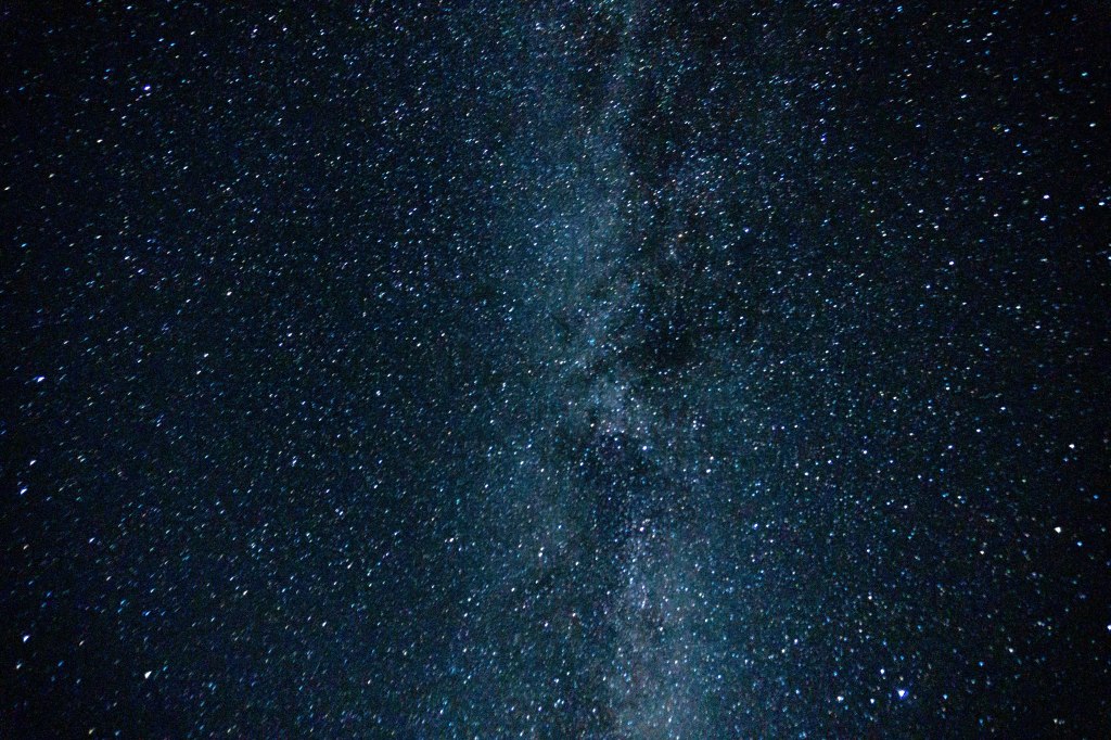
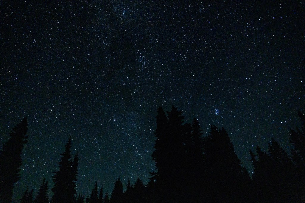
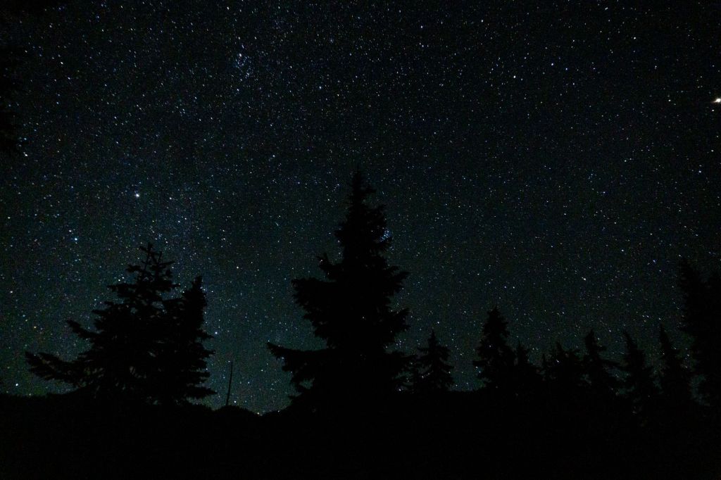
The campsite we picked was awesome. There were such beautiful views during the day. At night, we saw the Milky Way and had a panoramic view of the stars. This made me tear up a little bit. It was an emotional day. We decided to eat our Backpacker’s Pantry Chicken Pad Thai as a reward. It was so nice not having to clean any dishes today.
Along the way, we came up with more material for our album:
Marmots aren’t varmints / But they will break your heart / Take your truck and your money / And leave you tore apart
Marmots aren’t varmints / But God, I love them so / Marmots aren’t varmints / I thought you ought to know
*Marmot chorus interlude*
Marmots aren’t varmints / I hope I convinced you so / The love of a marmot / Is the purest you’ll ever know
So find you a marmot / To have and to hold / And keep it close to you / For country, God, and soul.
Day 23: Another crazy day in Section K
- Start Mile: 2521.8
- End Mile: 2507.3
- PCT Mileage: 14.5


I was thankful we camped near a toilet. It was really nice to have and there were great views. Despite this being the most remote section in WA, there are a surprising amount of backcountry toilets here.
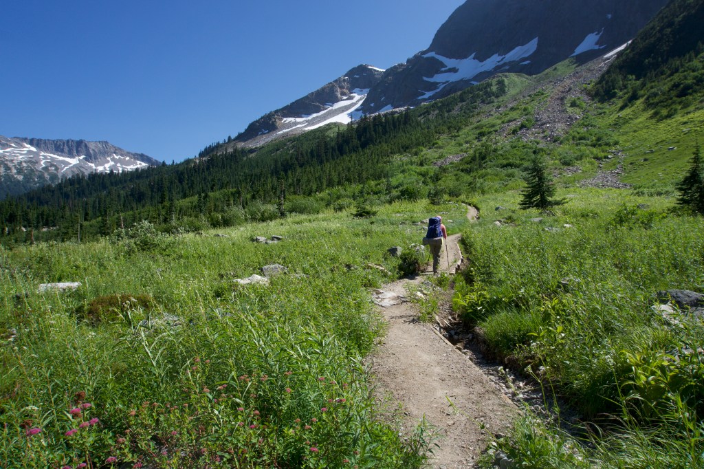
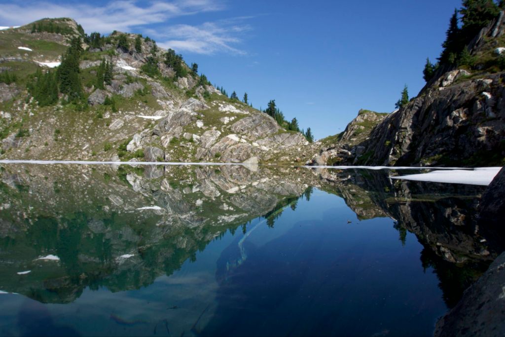
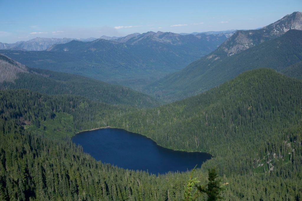
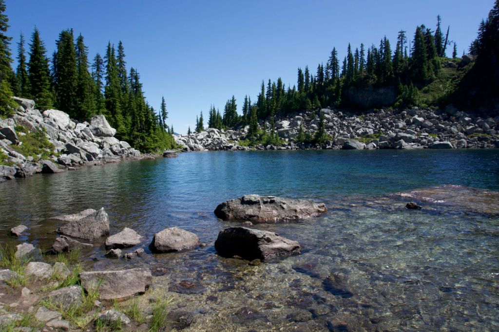
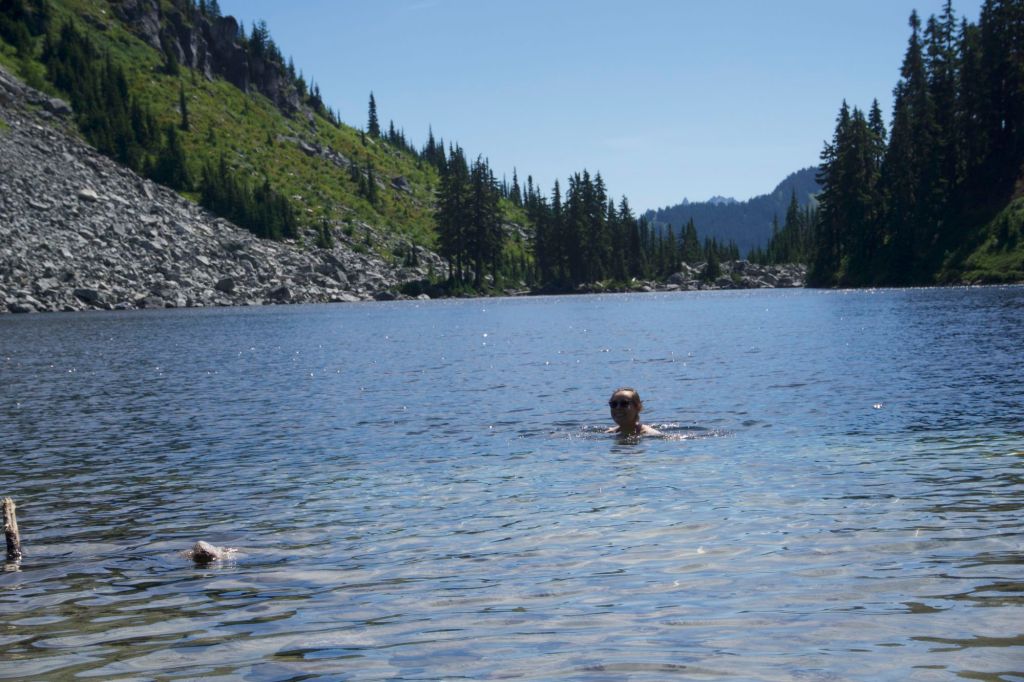
It was hard to wake up after our experience yesterday. We started hiking around 9:30am and walked a leisurely half mile to Mica Lake. It was quite hot even that early. The lake was absolutely gorgeous. I took a two second full body dip and screamed because it was so cold. Also because I slipped on a rock while entering the lake and accidentally fell in. Taking a dip in an ice cold alpine lake felt fantastic in the hot weather. It was actually my first time swimming while backpacking – I think all the other times it hasn’t been hot enough for me to want to swim. My clothes got a little wet, which was great because it kept me cool in the hot sun.
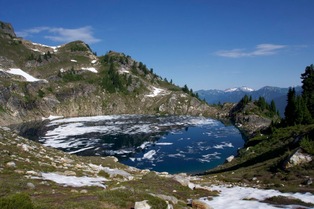
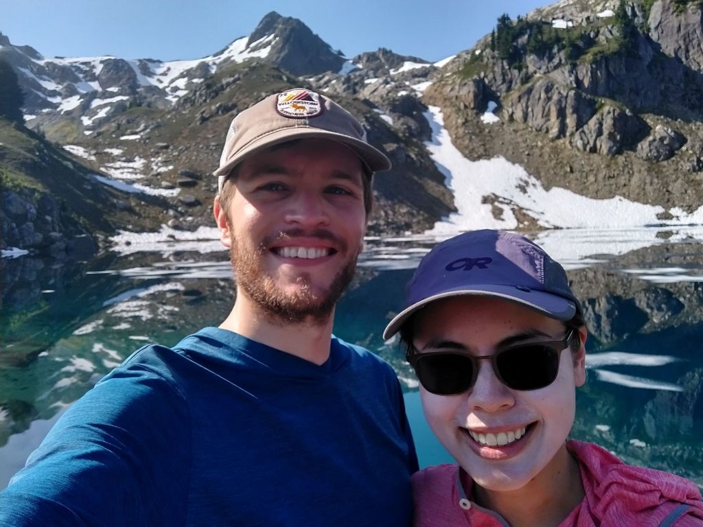
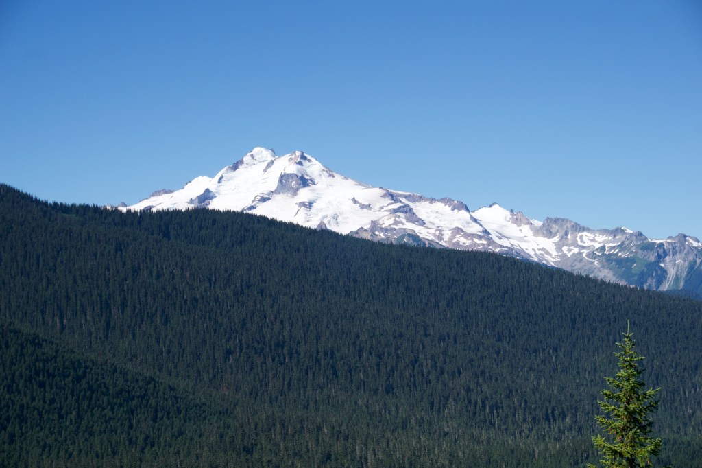
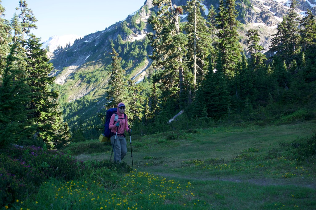
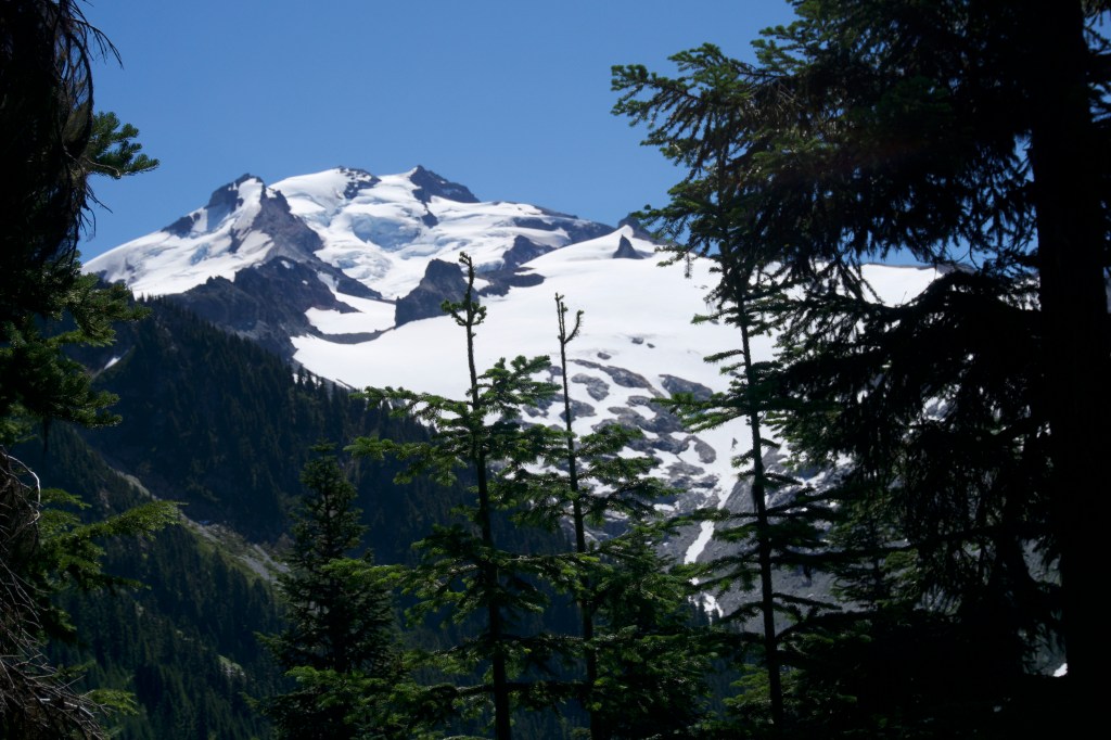
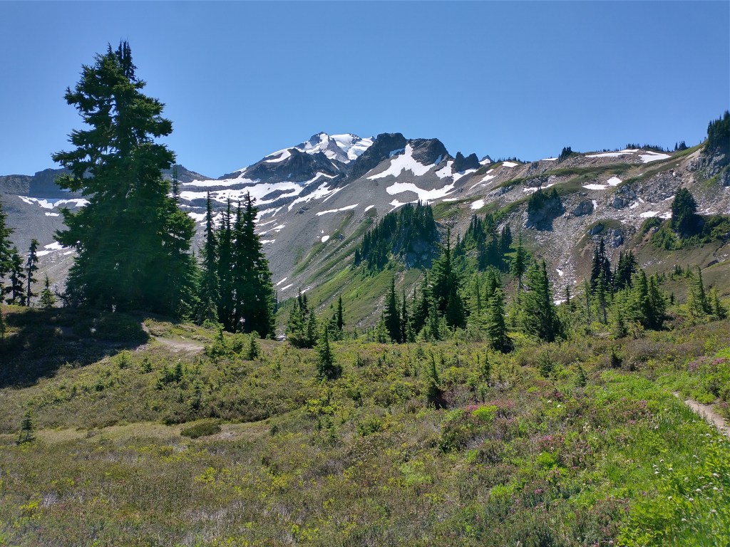
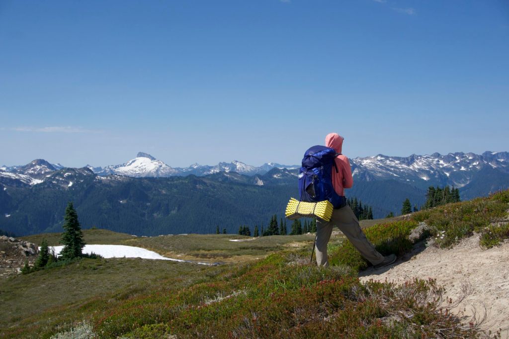
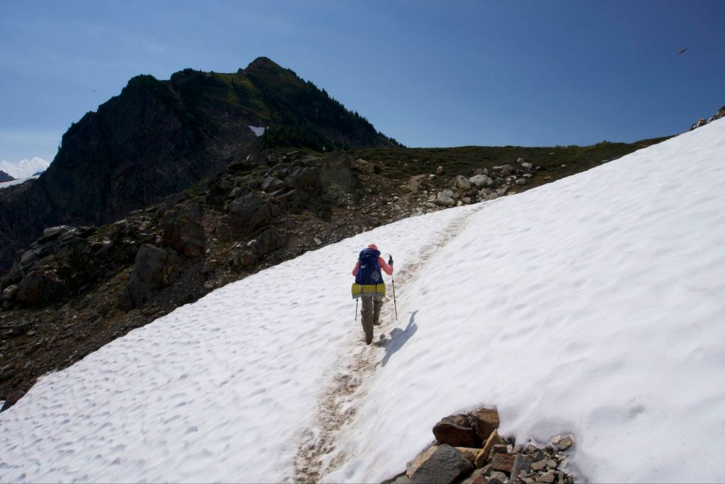
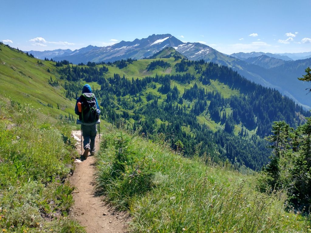
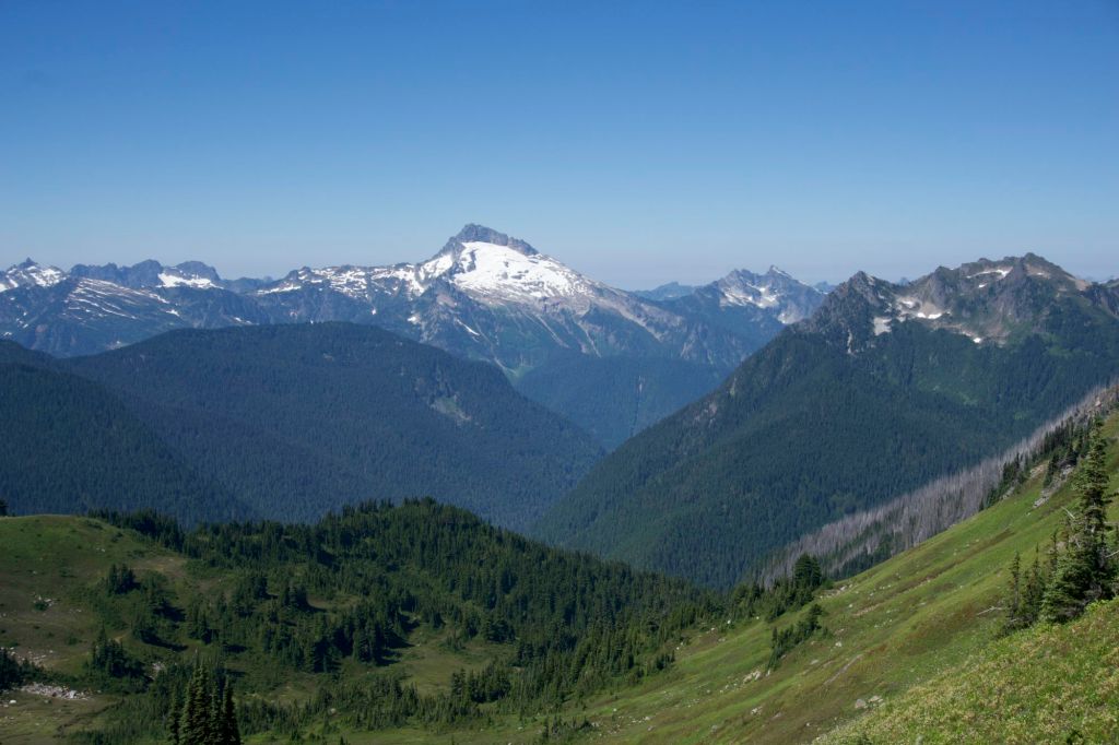
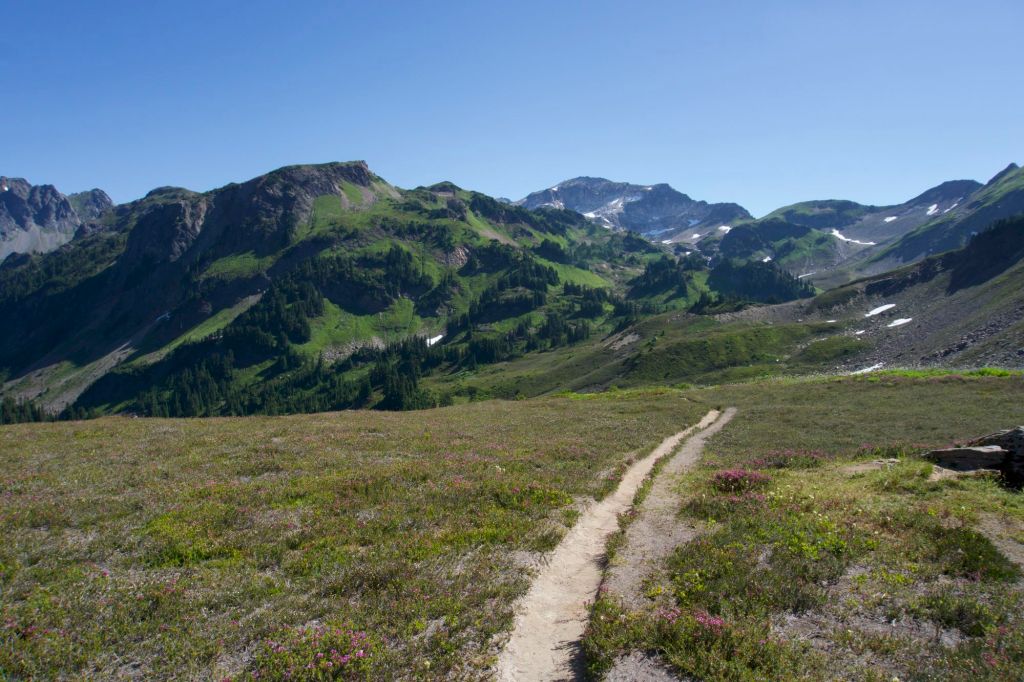
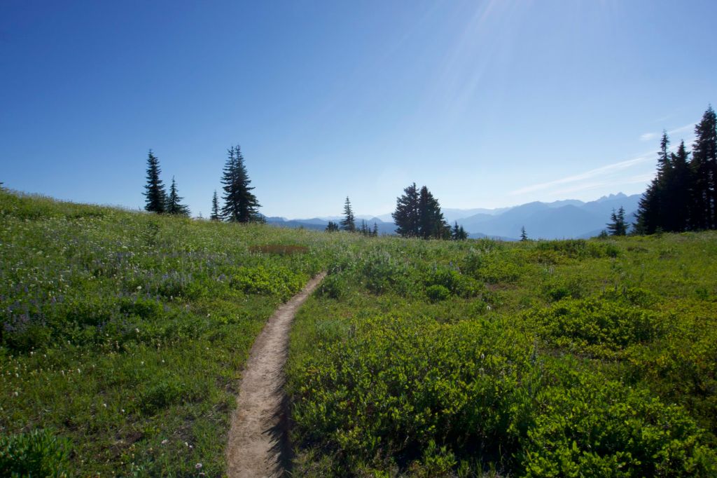
After Mica Lake we had a tiring, exposed climb to Fire Creek Pass. There was a small patch of snow near the top of the pass, but the snow was not difficult or scary at all. That’s the only snow we’ve seen so far in this section. The downhill was amazing – we saw the most amazing view of Glacier Peak. I can’t describe exactly how I felt upon finally seeing Glacier Peak, but I felt that it was all worth it. (Now would I do Section K again? I don’t know. But it was definitely was worth seeing Glacier Peak like that.) We literally sat down in the middle of the tiny trail and ate a snack to admire the view.
As we were walking, I came to the conclusion that the people who designed Section K hated hikers. There was nowhere to stop and enjoy the view of Glacier Peak. The trail also went just below a ridge which would have given us perfect views. Instead we were in the forest. We encountered some mild prickly bushwhacking on the way down (before I would have complained, but nothing can compare to the bushwhacking of the day before). There were so many creek crossings.
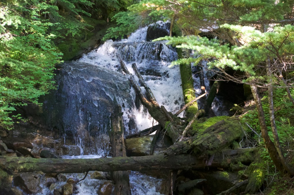
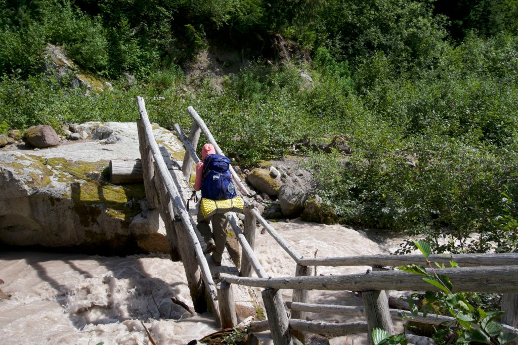
We crossed the famous Kennedy Creek downed bridge. I would really classify this as a river rather than a creek. I feel that crossing would be near impossible without a bridge.
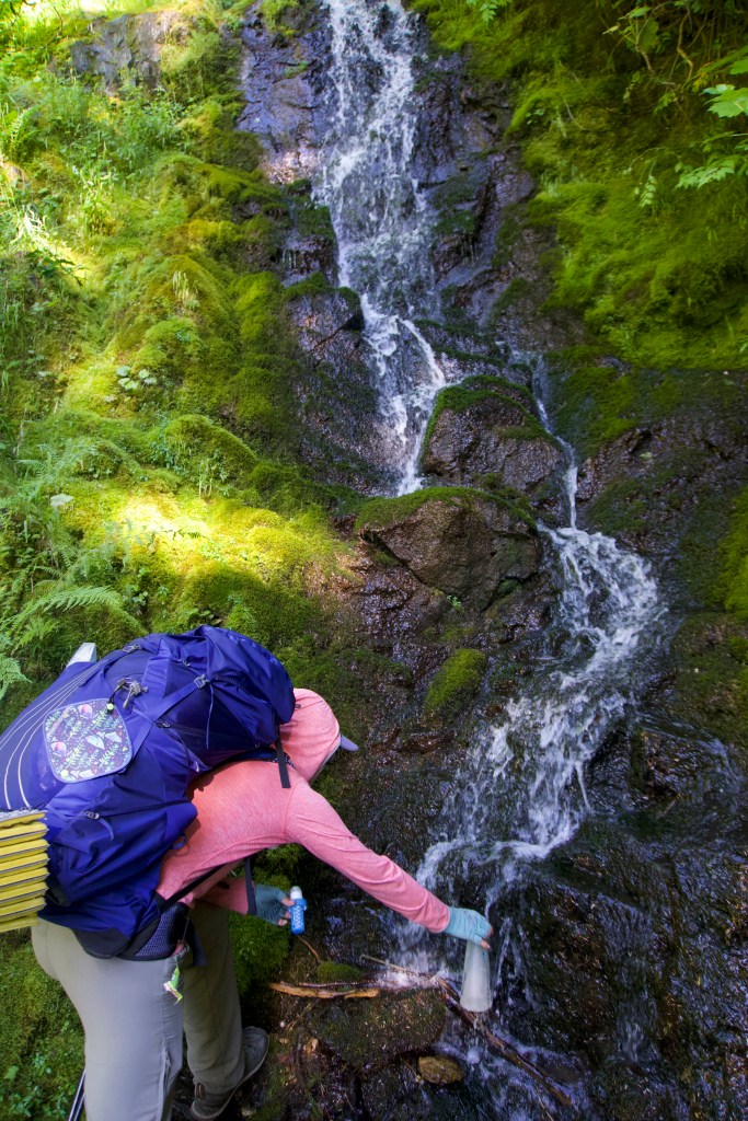
Shortly thereafter we encountered a half-mile section of underwater trail, or as we dubbed it, the Pacific Creek Trail. The entire trail was covered in ankle deep water with no opportunity to avoid submersion. We had been warned about this at the previous camp, thankfully. It wasn’t as bad as I expected, but I did not enjoy squelching my way through the mud and water.
Our final challenge of the day was the Baekos Creek crossing. Again, I would say that the word “creek” was a stretch to describe this large body of fast-moving water. Supposedly, there was a broken bridge that could be used for the crossing that was very difficult to find if you are heading southbound. This information proved to be accurate. We could not for the life of us find the bridge. We ended up going way too far upriver and partially crossed on what I would describe as an unsafe rock and log maze. The rocks were unstable and shifting as we tried to cross. I was sure that one of us would fall and slice a body part open on a log, and we would finally get a chance to use the full thickness wound care items in our first aid kid. Luckily this did not happen, but it was very stressful. I think this was actually the most dangerous thing we did on our trip.
We finally made it to the broken bridge and completed our creek crossing. Tempers were high. It felt so, so hot and it looked like it was going to storm. Fingers crossed we don’t have a thunderstorm and that there is not too much rain. Tomorrow I think we will finally leave the hellhole that is unmaintained Section K, but we’ll see.
Today we met some hikers on the trail who did not seem to have a clue where they were going. They asked us for directions and were several miles off from where they thought they were. Also, they got the names of the creeks confused. Hopefully they make it out without incident!
Day 24: The trail is no longer a hellhole!
- Start Mile: 2507.3
- End Mile: 2494.0
- PCT Mileage: 13.3


No more bushwhacking, dubious creek crossings, or underwater trail from now on! I do smell awful though.
Day 25: Grizzly Peak
- Start Mile: 2494.0
- End Mile: 2474.4
- PCT Mileage: 19.6


It was so buggy today. My feet and socks smell like cheese. I am covered with sweat. I both feel and smell like I’ve been bedridden with a fever for a week. I am truly disgusting. I need more calories. Next time I’m bringing more olive oil, double tortillas for every lunch, chips, honey buns, and more candy and fruit snacks.
We walked almost twenty miles today with 5600 feet of elevation gain! I felt fine until the last 4 miles when I felt like I was sleepwalking. We ended up with a higher mileage today since there were no water sources for a few miles. I think we can actually do this – increase our mileage so that we’re regularly doing 20+ mile days. My body must be getting stronger.
I was pretty happy with the food we carried on this section. I used ramen and peanut butter to make “hiker’s pad thai” and it turned out great. For peanut butter and jelly tortillas I would probably double up on the peanut butter to get more calories in.
Everything was not too bad today except the climb towards Grizzly Peak. I was quite tired at this point, but it did inspire another addition to our album.
Come sit by my fire / and I’ll tell you a tale / old as time (old as rhyme) / of the grizzly bear
Chorus: The grizzly, the grizzly, du du du du du
Once upon a time / there was a bear / who lived in the mountains / alone in despair (a lonely bear)
One day the bear saw / her golden hair / the shimmering locks / of the maiden fair
The bear wanted to know her / he wanted to see / but she simply thought that / he wanted to eat (so she turned around / and decided to flee)
That’s why they call this mountain / the grizzly peak / for it was here that the bear / met his defeat (a story so sad / and bittersweet)
O the peak of the grizzly / lies far above / O the peak of the grizzly / is where he fell in love (is what my heart loves)
We ran into the “Canada to Mexico” girl from Section J! I don’t know if she recognized us. Since we were doing sections out of order, that gave us the opportunity to meet some NOBO hikers twice. I felt that the NOBO hikers were about to get a rude awakening with all of the bushwhacking ahead of them.
Sally Ann Lake was quite beautiful. We had a good lunch at Pear Lake and met some nice NOBOs. We encountered a few hikers who were only doing Section K. Having just gone through the difficult part of Section K, I could not fathom why anyone would want to do Section K if you had the choice. Surely Section L or Section J would be better? In hindsight, Section K is pretty amazing, if you’re not afraid of serious elevation gain, bushwhacking, underwater trails, and interesting creek crossings!
We shared a log at Janus Lake (hopelessly buggy) with M., an older gentleman doing the Washington PCT in sections.
We were asked if we were thru hikers twice today. It must be because we’ve really started to reek, so now we both look and smell the part.
Day 26: We’re getting out!
- Start Mile: 2474.4
- End Mile: 2464.7
- PCT Mileage: 9.7

Today was the day! We were finally returning to civilization for a brief interlude in our wilderness journey. We were so stinky, so hungry, and actually ran out of snacks for the first time. I had been hungry yesterday, but today I was so hungry that I was running out of steam. I told Tim that I had this fantasy that when we arrived at Stevens Pass, someone would be in the parking lot grilling burgers and offer me one. This was highly unlikely due to Stevens Pass being closed due to COVID, but hey, a girl can dream, right?
As we got closer and closer to civilization, we started seeing day hikers. In fact, there were a veritable horde of day hikers (mostly retirees) near Lake Valhalla. So many people wanted to talk to us. One particularly kind lady said, “I bet you just want a hot meal and a shower and a warm bed!” She had indeed read my mind. I agreed, saying “Oh yes, we’re so hungry” while giving my best puppy dog impression. She offered us homemade chocolate chip cookies which were perhaps the most delicious things I had ever tasted. She also gave us her peanut butter pretzels. I lightly protested once to be polite, but it didn’t take much for me to accept. I felt so much better after eating them. An older gentleman also gave Tim a Werther’s caramel. He didn’t even have to beg to receive it.
Lake Valhalla was quite nice. It was really pleasant and great for a dip. We hung out at the lake for some time since A. couldn’t pick us up until 6pm. Then we leisurely strolled to Stevens Pass from the lake. The PCT was quite pleasant and like a well-traveled road at this point, a far cry from the seemingly unmaintained trail we had encountered through most of Section K. Upon arriving to Stevens Pass, my burger fantasies were sadly not realized, but I suppose there’s always next time. We hung out outside of the lodge while waiting and charged our devices. While there we met a recent college grad from Mercer Island who was doing the Washington section NOBO before starting work. She warned us that the next section we would encounter was not that scenic. I suppose that although Section K had tested our physical and mental capacities in myriad ways, the views were absolutely incredible. Maybe even worth the pain!
A. picked us up and we stopped at Rico’s pizza on the way home! We headed home and promptly showered and passed out.