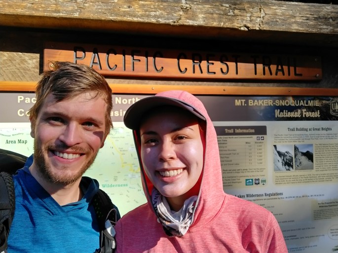
We decided to do a few sections out of order due to high snow levels. Instead of finishing up Section L and Section K by hiking from Hart’s to Stevens, we skipped a letter of the alphabet and decided to do Section J: Stevens Pass to Snoqualmie Pass.
Day 8: Stevens Pass
- Start Mile: 2464.7
- End Mile: 2452.6
- PCT Miles: 12.1
My sister C drove us to Stevens Pass. Stevens is our home ski base, so it felt like we were just heading to the pass for a ski day. On the way, we stopped at the Sultan Bakery for a delicious and overly-filling breakfast. I had the breakfast sandwich and half a cinnamon roll – I could not finish the sandwich for the life of me. We also packed out a German sausage roll and breakfast burrito for lunch. I discovered that you could pack real food for the first day on trail – it’s definitely worth the extra weight!
We didn’t start hiking until 1pm, but we still managed to go 12 miles. I had a bad sugar headache upon setting out, and I had to take some ibuprofen and a break. After that I felt fine. I probably shouldn’t have indulged so much at the bakery! It was interesting to see Stevens Pass without snow and to hike where I normally ski. The ski resort section was not very scenic, but it was cool to see my favorite chair lifts. We found a single child’s ski stuck in the brush and left it by a service road – hopefully someone from maintenance will find it and pack it out.

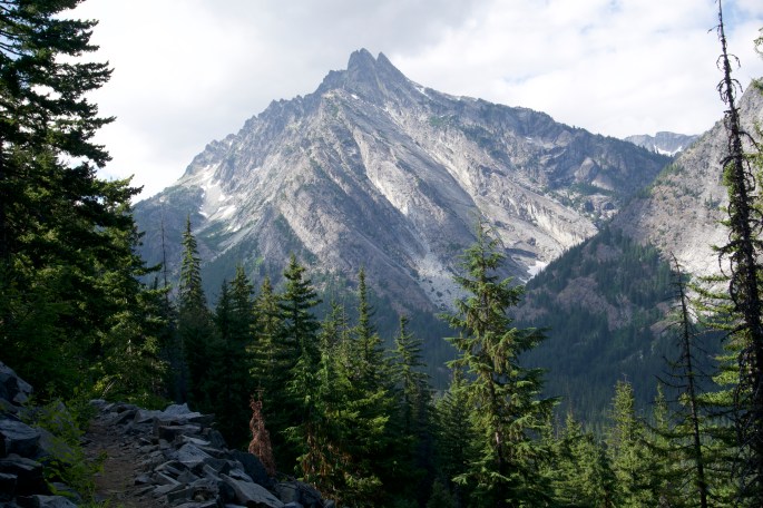
As the daylight waned, we made it to our campsite. It had some nice views and was at a high point on the trail. The campsite was basically on the trail, so we tried to set up our tent as far away from the main footpath as possible. At 8:30pm, 3 hikers with separate tents and a dog rolled up and somehow managed to pitch their tents in the remaining space. They were super courteous and good neighbors. Then at around 2am, 2 more hikers rolled in, headlamps a-blazing. I honestly have no idea how they pitched their tents, but they did it. It really felt like half the world was camped there.
Day 9: Cascading stream or raging river?
- Start Mile: 2452.6
- End Mile: 2438.3
- PCT Miles: 14.3
Yesterday we realized that we could finish the section in 5 days instead of 6, so we increased our average daily mileage to 14.
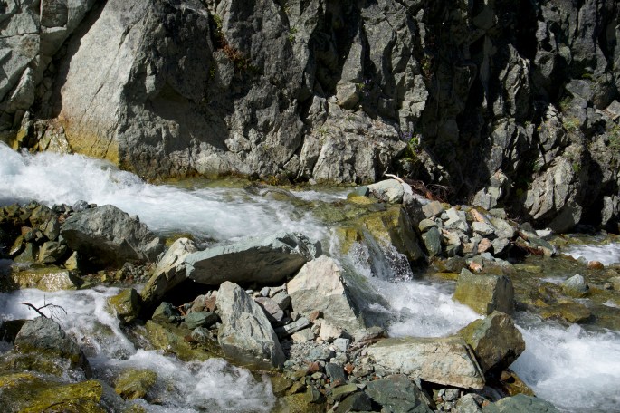
Today marked my first significant creek crossing! We had to cross a large moving body of water that was labeled “cascading stream” on Guthooks, which according to other hikers should be more accurately labeled “raging river.” I was pretty nervous about this crossing since people had been hyping it up on the PCT Facebook group (NB: this is probably the least reliable source of PCT information). I don’t have a lot of creek crossing experience, so I was worried about being swept away. Many people are worried about being attacked by wild animals in the outdoors, but it’s much more likely that you’ll die in a creek crossing, from a falling tree, or falling off a cliff in icy conditions.
The creek crossing wasn’t that terrifying in the end. We found a safe way to cross by heading quite a ways upstream where the water was less deep. This involved a significant portion of rock hopping. Even then, the water went to our knees. It was moving quite fast, and I really had to struggle against the current when crossing. It wasn’t bad enough that we felt we needed to link arms, but we unbuckled our packs in case we got swept away and made sure to have 3 points of contact with the creekbed at all times (legs and trekking poles). Afterwards I felt very proud of myself for completing the crossing safely, even though it was not that bad – I’m sure the ones in the Sierra are much worse. Plus, it was nice and warm so our shoes and pants dried out quickly!
There are so many beautiful lakes here; I can’t even keep track. The Alpine Lakes Wilderness is aptly named!
Day 10: Now I’m sore
- Start Mile: 2438.3
- End Mile: 2422.9
- PCT Miles: 15.4
My IT band was super sore! I hadn’t been rolling or doing any PT up until this point. At night I rolled extensively, and in the morning I felt better. It was a good lesson to remember to stretch.
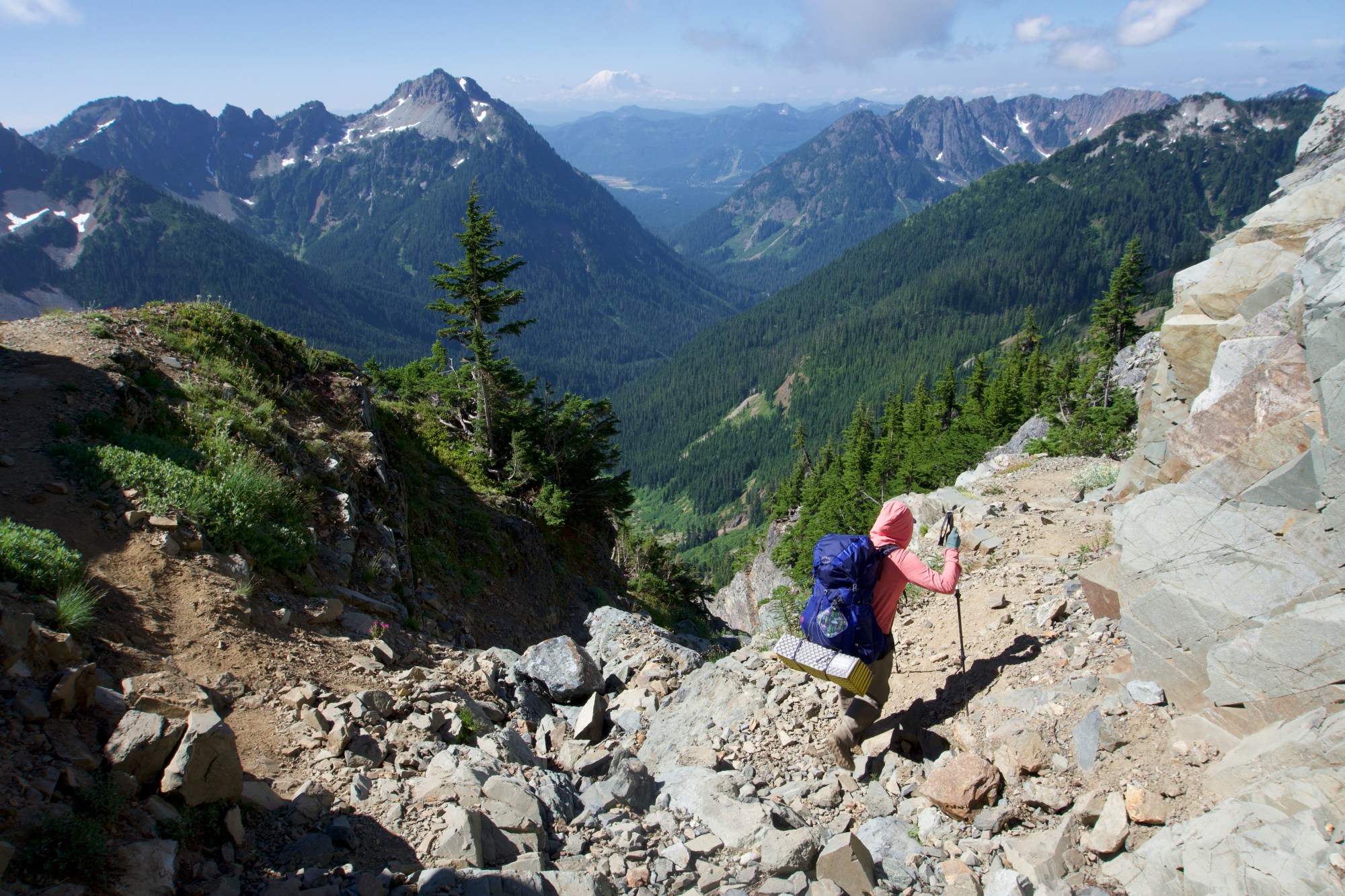
We went up and down and up and down. Our theme during this section was to camp at the top of a mountain (usually a dry camp, so we had to haul all our water up there), descend to a valley, and then hike to the top of another mountain and camp there. It was so much tougher than Hart’s Pass.
During this section, I tried a stick sunscreen from Bare Republic. I like stick sunscreens because when you reapply, your hands remain sunscreen free (instead of getting super gross after applying multiple times a day). However, one thing I did not anticipate is that this sunscreen contained glitter. My face, shirt, trekking poles, pillow… everything shines with the light of a thousand suns. In addition, since it is a mineral sunscreen, it gives my face a slight white cast. I think I look a bit like a Twilight vampire. My trail name should definitely be Sparkles at this point.
More gear talk: I also tried out Injinji liners under my Darn Tough socks, since I had gotten hotspots between my toes last time. Now I don’t have any hotspots! I was skeptical initially, but I think I’m going to continue to use them.
We encountered the suggestively named Bear’s Breast mountain. I guess I see what they mean, but really? You couldn’t name it anything else?
The trail was beautiful today, but the highlight was Waptus Lake. We noticed that the PCT passed close by and that we could take a 2 mile alternate trail that went by the lakeshore. Unfortunately, we only noticed this halfway through so we only got to see a bit of the lake, but it was absolutely gorgeous. There was nothing spectacular happening on the PCT so the alternate is the way to go. I would definitely go back to Waptus Lake for a weekend backpacking trip. We stopped to eat lunch off the lake in the shade and took an extended break. I practiced some yoga on my sleeping pad. It was very calming and really helped my sore muscles.

Day 11: SURPRISE CREEK CROSSING
- Start: 2422.9
- End: 2408.4
- Miles: 14.5
Today involved a surprise creek crossing! The bridge at Lemah Creek was out. Luckily, the water was only knee deep and not fast moving, so it wasn’t difficult at all. Before the PCT, I used to get quite fazed about surprise obstacles, but I took this one in stride.
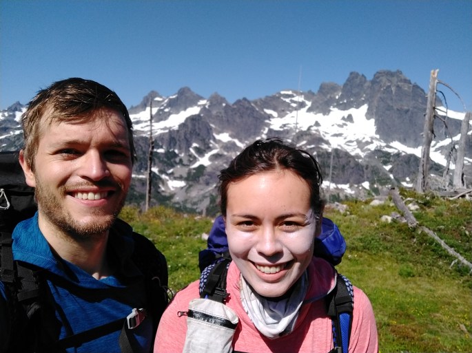
My favorite part of Section J was the Lemah Mountain area. The white trees were so pretty and it was a unique landscape.
This section had lots of wildlife. We found lots of frogs and bumblebees, plus some interesting red succulents. We did walk on snow for about 3 whole feet, so I can’t say it was a completely snow-free section!
Day 12: BURGERS AND BEER
- Start: 2408.4
- End: 2393.6
- Miles: 14.8
I was definitely dreaming of burgers and beer towards the end of the hike (my usual MO). I think Hart’s Pass spoiled us. It was much easier (in terms of elevation gain) and so stunningly beautiful. Literally every mile you would turn the corner and there would be another incredible and surprising view. Not to say that Section J was not beautiful, but we spent a lot of time hiking up or down 5 miles in forests without a view (not a bad thing, just different from Section L). Also, there were so many other hikers! We were constantly passing people on trail and never camped alone. I had gotten used to the relative remoteness and isolation of Harts Pass, but there are many popular backpacking trails in the Alpine Lakes Wilderness that you can access from other roads.
We stopped for lunch at Ridge Lake, and it felt like half the world had stopped with us! It’s a popular day hike or backpacking trip from Snoqualmie. We were pretty wiped out by this time and just wanted to get home.
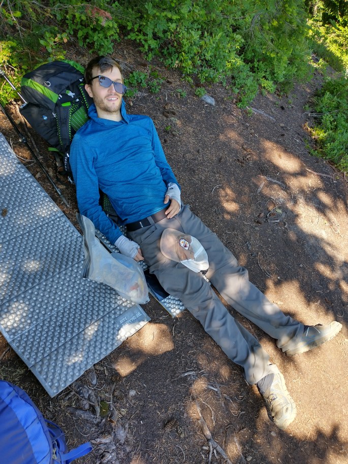
The last 6 miles of Section J felt like the longest 6 mile descent in the history of ever. I could see Snoqualmie Pass in the distance but the trail took the longest, most circuitous route to get there, and we were so tired and just wanted beer. Plus the last 8 miles or so of the trail involved extensive walking on big rocks that slid around, so our feet HURT. Tim was limping, as he had hurt his quad at some point. I felt fine except it felt like someone was pounding my feet with tiny hammers. My left index toe hurt. I can tell you that I have never had a specific toe hurt while hiking before.
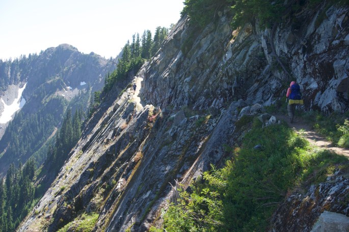
I had not hiked the Kendall Katwalk before, but it is a popular local day hike so I was really hyped up. I thought I was going to walking along a tiny cliff’s edge fearing for my life. When I got there, I was like… this is it? I wasn’t afraid for my life at all! It just looked like a normal section of trail with a steep drop-off. In hindsight it was pretty cool – the trail had been blasted into the rock face on Kendall Peak, which was a monumental and time-consuming engineering effort, and there are incredible views all around. However, I was so focused on getting home that I couldn’t properly enjoy it, plus I was already spoiled with all the beautiful mountain views from the rest of the section.
Finally, we made it to Snoqualmie Pass. We had amazing beers (Berliner Weisse at Dru Bru) and a satisfying burger and fries at Commonwealth. Also an apple crisp. We ate EVERYTHING. P picked us up which was so nice of him and awesome. Then we got an extra day at home because we had pushed it! Next up, we’re going to return to Hart’s Pass and head south to finish sections L and K.