Day 1: Hart’s Pass
- Start Mile: 2623.7
- End Mile: 2633.5
- PCT Miles: 9.8
To start our journey, we drove to Hart’s Pass, the northernmost American trailhead of the PCT. It’s about 30 miles from Hart’s Pass to the Canadian border and the Northern Terminus of the PCT. Since entry to Canada was illegal due to COVID, we would have to tag the border, turn around, and re-hike the 30 miles back to our car.
It took us about 4.5 hours to get there. On the way, we passed through North Cascades National Park and almost hit a small dog that was standing in the middle of the road. We passed through Mazama, the last bastion of civilization before the Hart’s Pass trailhead, and started up a “narrow, windy mountain road with steep side cliffs in places” (quote taken directly from the US Forest Service website). At first I thought that the road didn’t seem so bad. Within a couple of miles, I understood. The road is tiny, rocky, off the side of a cliff, and riddled with deep potholes the size of small children. We had to go slowly in order to make it through in one piece. We felt safe, except for a short section where the road narrowed to one car-width with a sharp drop off.
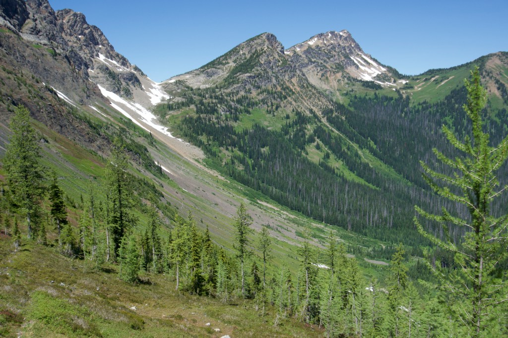
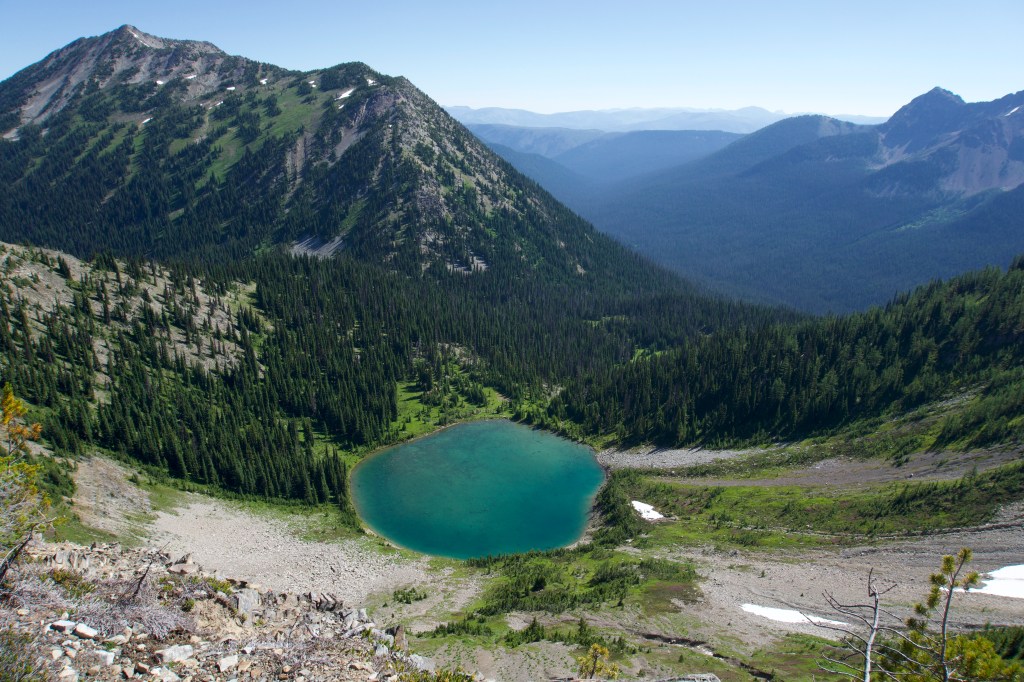
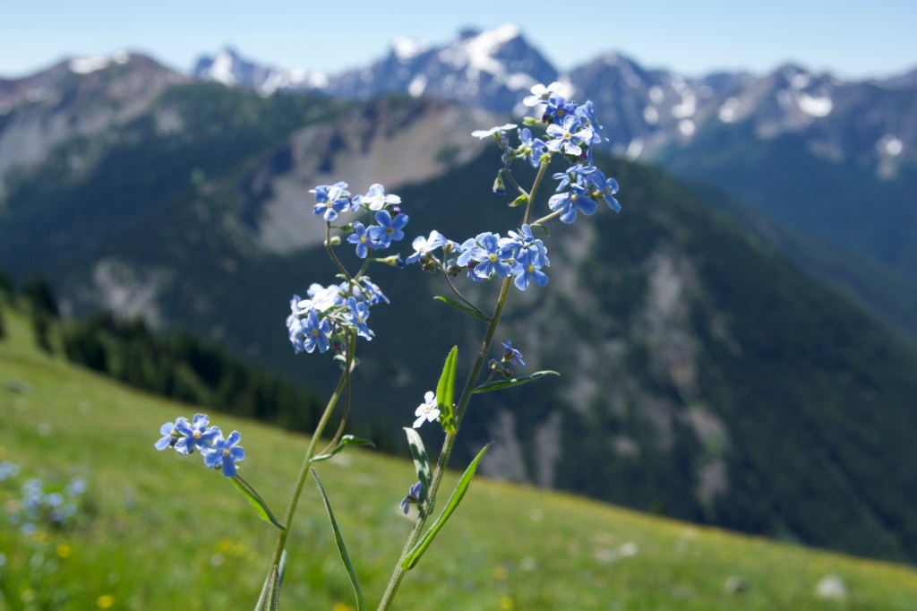
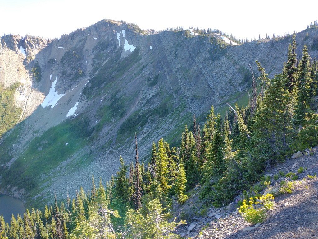
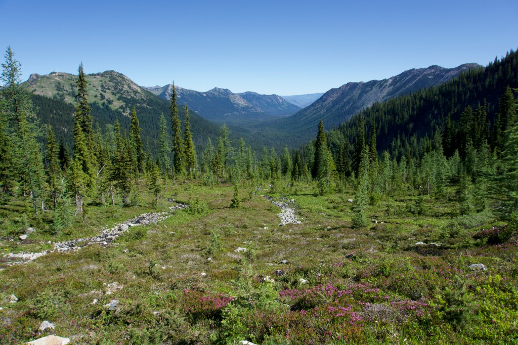
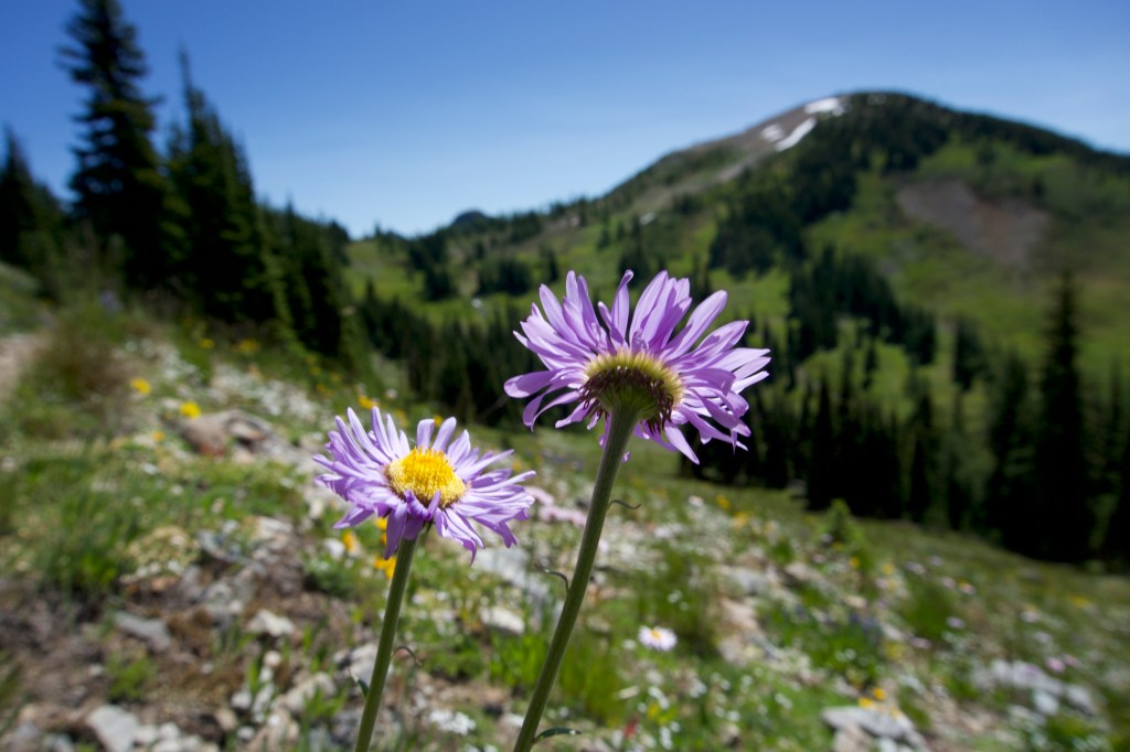
After the hour-long journey up 12 miles of questionably maintained Forest Service road, we got to the top. We were surprised by the number of campers and day hikers who had made the long journey to a campsite with no water and no other amenities besides a pit toilet. But the views were breathtakingly beautiful, even from the trailhead. There were mountain ranges as far as the eye could see, and colorful wildflowers everywhere. The weather was perfect – warm but not too warm. It seemed so surreal. I couldn’t believe we were starting the journey that I had been dreaming about for years. It felt like we were just doing a backpacking trip on a long weekend.

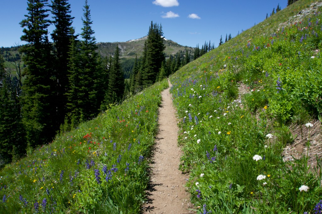
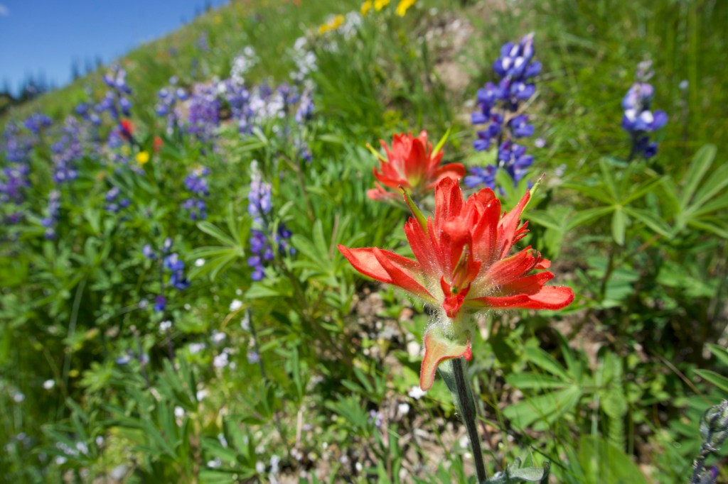
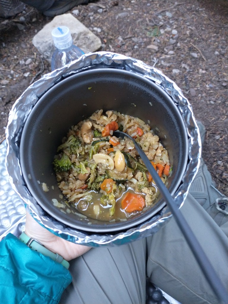
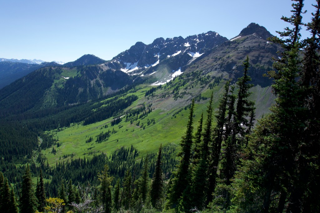
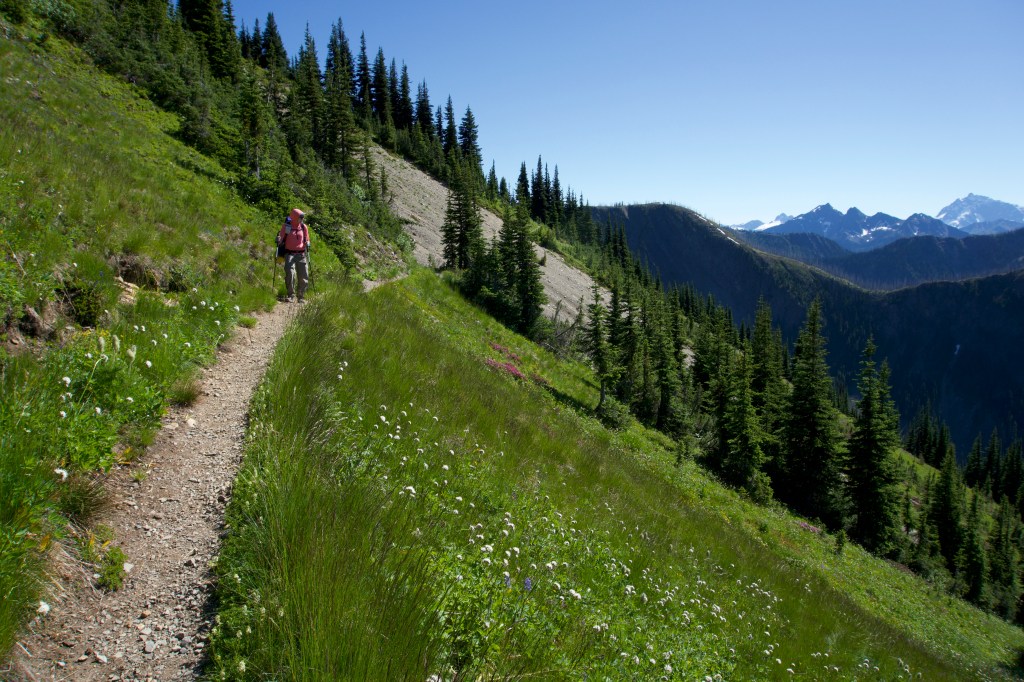
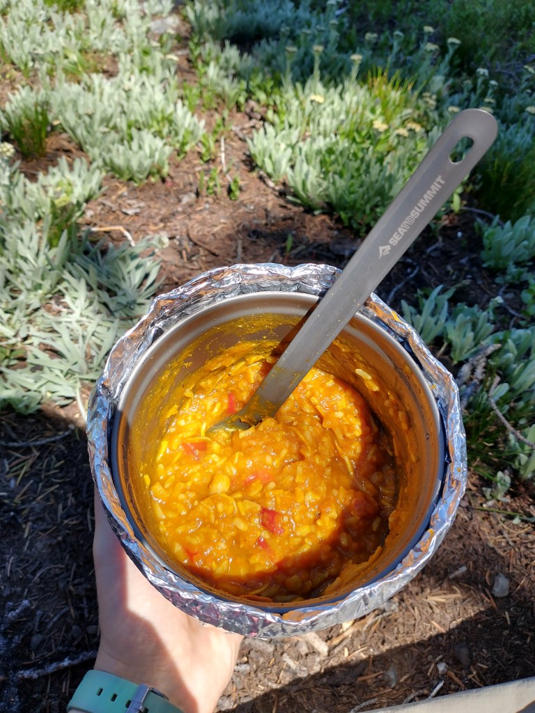
We were in awe for the first 3-4 miles. It felt like we were hiking on the postcard version of the PCT. The elevation change was super gentle, and we had panoramic views of mountains, birds chirping, flowers… it felt like paradise. At around mile 8, the light started to wane, and the mosquitoes started coming in at full force. We fought our way through increasingly dense clouds of bugs until we reached camp. It was full of mosquitoes, unsurprisingly. There was a water source nearby which was quite nice. We had neighbors: a large group of hikers that we didn’t interact with much. We also made our first dehydrated meal: Thunder Stir Fry. It actually wasn’t that bad, but would have been improved with Sriracha, which we resolved to bring in the future. As we went through the process of setting up camp, I was reminded of how annoying camp chores are: cook, eat, clean, wash dishes, set up the tent, brush teeth, store food… And you have to do it every day.
In order to start off slowly and avoid injury, we were originally planning to do 10 miles a day and finish the section in 6 days. But we did 10 miles on the first day and felt fine, so we decided we could finish the section in 5 days instead. I went to bed feeling happy (and itchy).
Day 2: Dry Camping
- Start: 2633.5
- End: 2649.4
- PCT Miles: 15.9
Today we saw 4 baby grouses, a marmot, lots of bear poop, and heard about a supposed mountain lion and goat sighting. Thankfully I did not see the mountain lion – it would have scared the crap out of me!
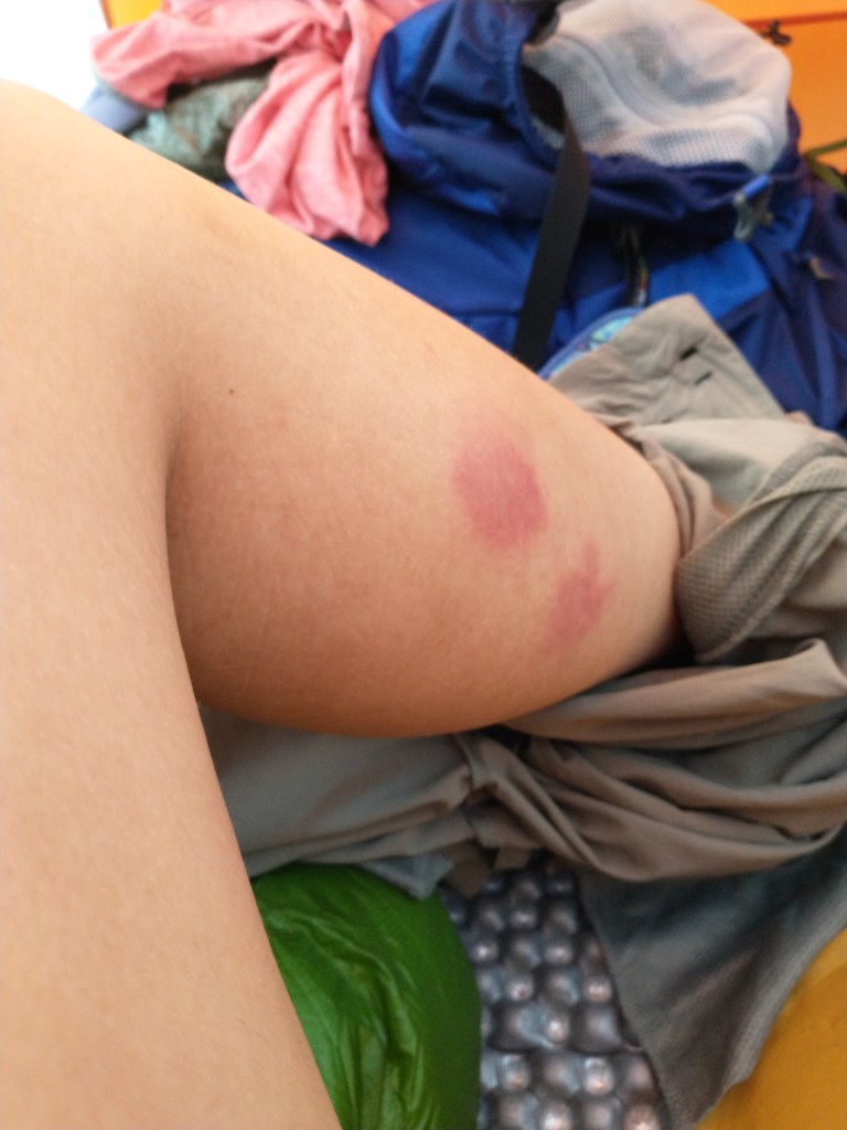
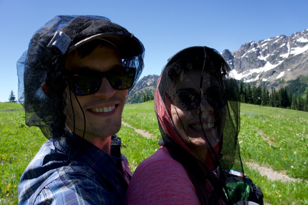
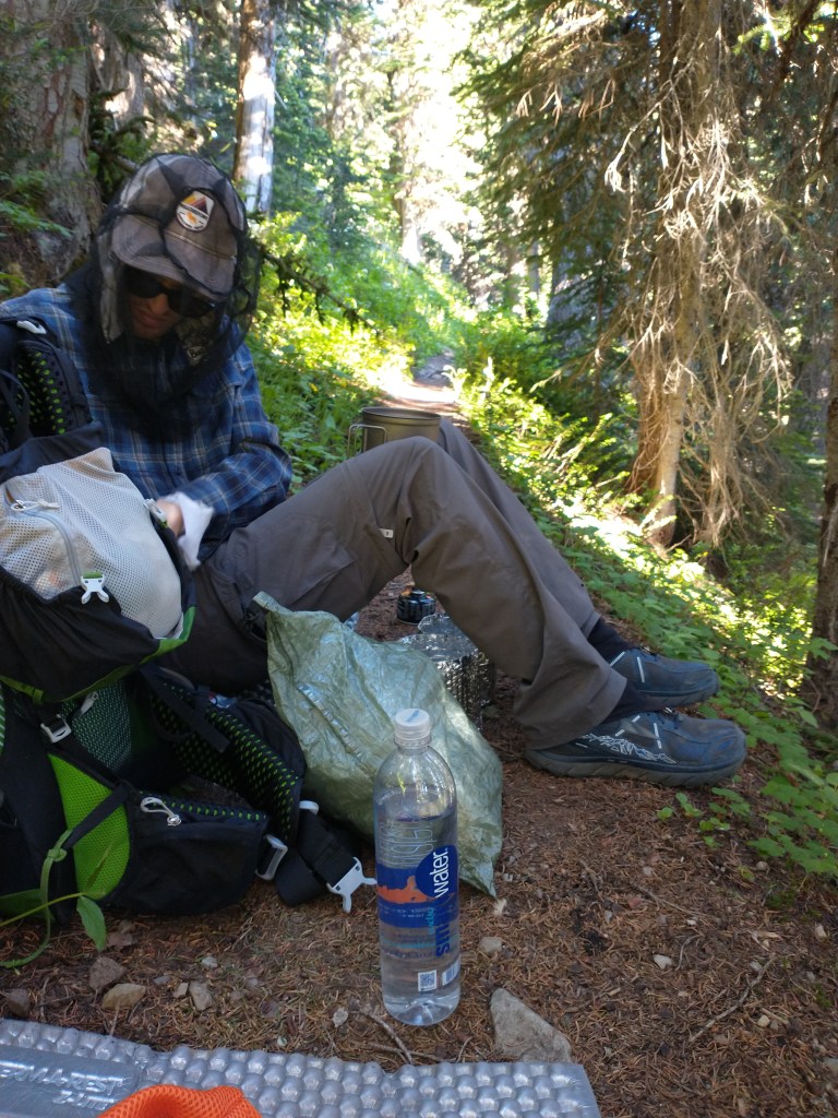
The one animal that we consistently saw were mosquitoes. As I was doing my business in the morning, they bit every inch of exposed skin they could find. We tried to avoid mosquitoes with little luck, and had to hike with our bug headnets on for some time.
As we hiked, I mentally reviewed my gear choices. Rants: We were mildly delayed by my Sawyer Squeeze filter, which takes some time to filter. I was jealous of Tim’s Katadyn BeFree, which filters as you drink it so you can just collect water and go. (Note: You can also do this with the Sawyer Squeeze, but it’s a bit unwieldy in my opinion.) I decided to try out the Katadyn on our next section. I had brought a fleece in addition to a puffy jacket, but it had been super warm on the trail, so I decided to ditch the fleece when I got home. My Trader Joe’s zinc sunscreen felt slimy and made me look like a ghost, so I wanted to find a different sunscreen for next time. Raves: My Kula cloth (affectionately known as the “pee taco”) was life-changing. It’s a small antibacterial cloth that you can use to wipe when you pee. It folds up into a little triangle to attach to the outside of your pack – hence the taco nickname. It saves so much TP and is quite sanitary. I also loved my homemade pot cozy. It retained heat so well – we could just pour boiling water into our pots and the food would rehydrate without a problem. I was also happy with my choice of phone: the Motorola Power G8. It has a crazy battery life. I had 80 percent battery after 2 days of heavy use, which included frequent use of Guthooks (the Google Maps of the PCT) and the Kindle app.
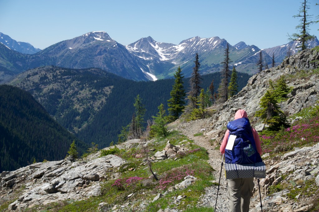


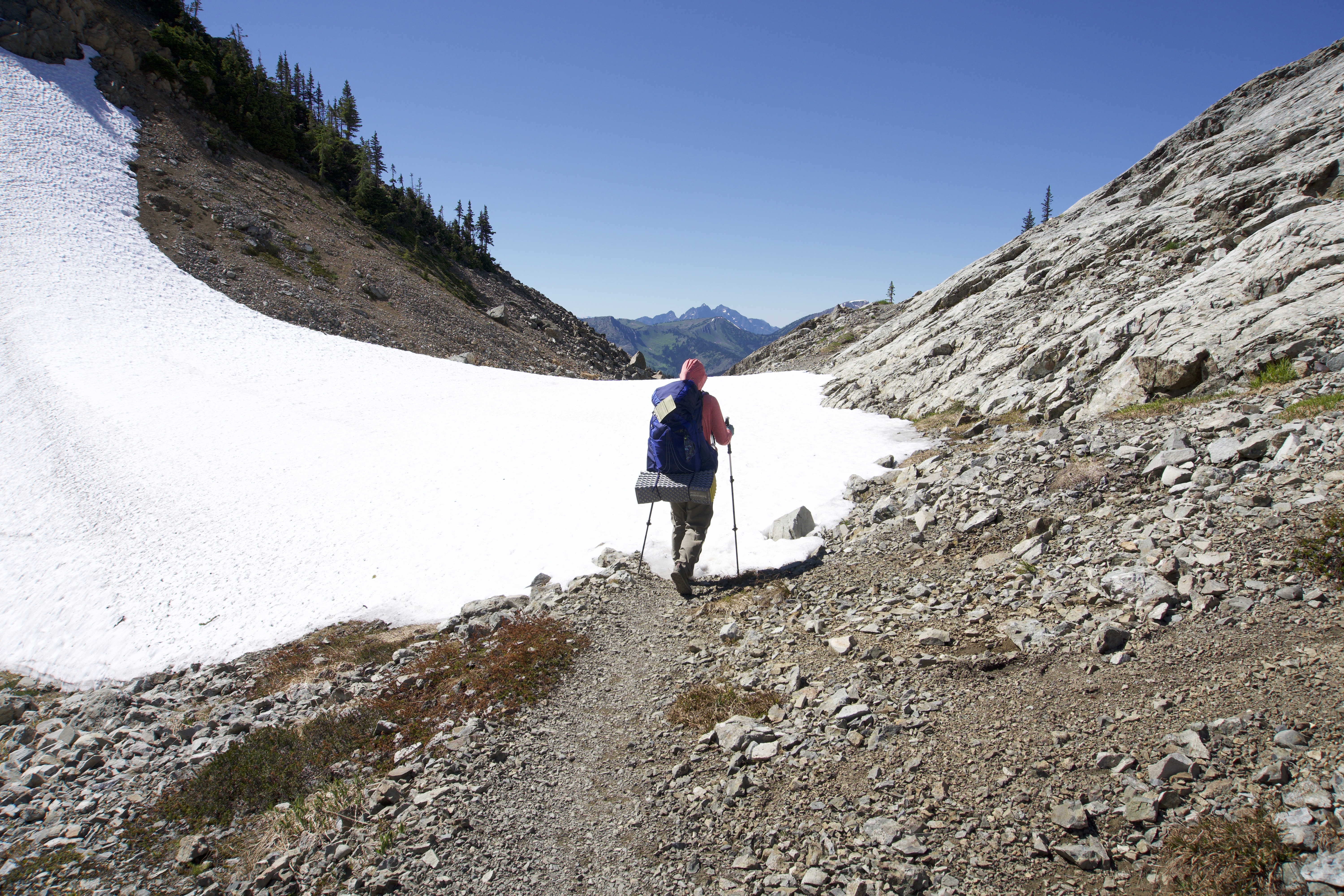
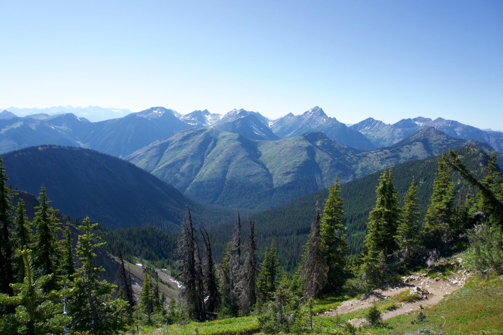
We hiked through many more gorgeous landscapes, finally reaching Rock Pass. There was a lot of hullaballoo going on about Rock Pass on the PCT Facebook group due to a large snow cornice covering the trail with a steep dropoff. Luckily by the time we got to it, it was only mildly terrifying, but I don’t think it was super dangerous. Had we encountered it a week or two earlier, I would have felt it prudent to bring an ice axe.
I felt pretty good until we got to Woody Pass, where I got tired due to the heat and elevation gain. We had an awesome one hour lunch up top where I regained my energy. I ate a cherry pie, which brought back childhood memories of eating those pies while shopping at Costco. I did PT exercises for my ankle over lunch and also rolled on my massage ball before going to bed. My PT would be so proud.

Based on information from other hikers about the bug situation, we decided to camp at Castle Pass, the last campsite before the border. It was a dry campsite, which was a bit of a foreign concept to me, as I was used to hiking in places with abundant water sources. To make this work without carrying oodles and oodles of water, we stopped at the nearest water source a mile away from camp and cooked dinner on the trail. We then carried our meals to camp and ate there. Our second dehydrated meal, Pine Valley Couscous, turned out super well – it’s the sort of meal I’d actually cook at home.

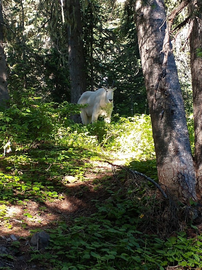
When we got to Castle Pass, we found a fellow hiker already camped there. His name was Fast Hiker and he was from Arizona heading SOBO (southbound). He had quite the setup, including a chair, which I was intrigued by, but would not have wanted to lug around myself. I felt better when he said he had done 18 miles today – we had done 16, so perhaps we weren’t so slow after all! The camp was surprisingly nice (certainly better on the bug front than our previous campsite), and we had a couple of curious mountain goat friends who wanted to hang out with us. We named one Arnold Schwarzenegger; he was very muscular.
Now I am legitimately feeling sore. Luckily the PCT grade is gentle, but we still did several thousand feet of elevation gain. Mostly my feet hurt. No blisters so far (fingers crossed). My mosquito bites, though huge and swollen and everywhere, are actually not bothering me that much. We’re so close to Canada!! According to other hikers, apparently tomorrow we’re going to have to bushwhack our little butts off. Hope we don’t die. Guthooks is awesome.
Day 3: Canada!
- Start Mile: 2649.4
- Northern Terminus: 2653.1
- End Mile: 2646.7
- PCT Miles: 3.7
- Total Mileage: 10.1
I thought we were going to get out of camp fast and do a higher mileage day, but Tim laid in bed forever. It made sense, considering Arnold the mountain goat had kept us up all night by pawing around the campsite and breathing heavily near our tent. Since we were doing an out-and-back today, we decided to leave our tent up and leave most of our gear behind.
We left for the border with lighter packs and a little bit of trepidation. Every hiker we passed the day before had complained about the last 3 miles to the border. Apparently that had been no trail work done since the previous year, and there were over 40 fallen trees that necessitated the practice of “PCT Parkour.” We were advised to be very careful, since the brush was so thick that sometimes you couldn’t see where you placed your feet. Once we got out there, it wasn’t as horrible as I imagined it might be, but getting around some of the trees was really annoying. My ankle hurt from all the clambering about, and I got a ton of sap on my hands.
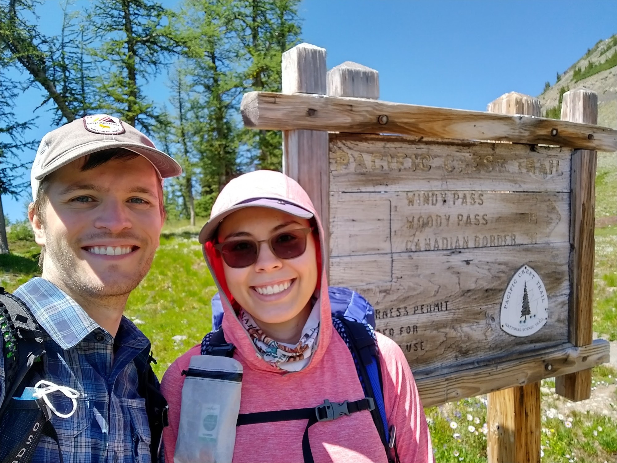
Finally, we got closer to the border, and the path started to clear up a bit. I got goosebumps after seeing the 1 mile trail sign. I imagined how it amazing would feel to be hiking the last mile as a thru-hiker, after going through so much to get there and knowing that you are finally going to complete your journey. Seeing the terminus in person was definitely worth hiking an extra 30 miles.
There was no border security, because the only way to reach that section of the border is by hiking 30 miles from the American side or 8 miles from the Canadian side. There was a giant swath of trees cut at the border. I wondered how long it might go.
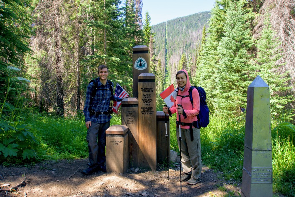
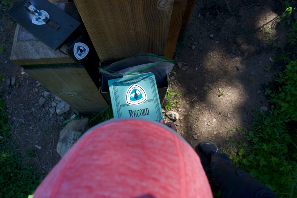
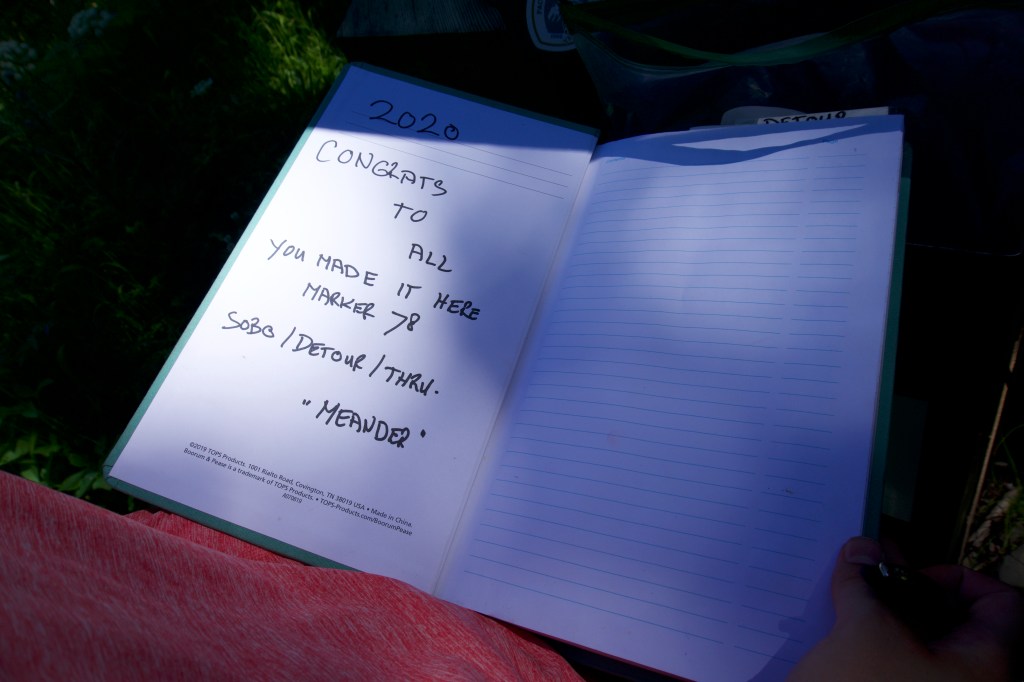
We took an extended break at the border and soaked it all in. We walked a few feet into Canada, and then walked back. We took some photos, but forgot to take a photo in our masks to commemorate the pandemic – oops! I enjoyed reading the trail register. There were around 80 SOBO hikers before us. This was significantly less than usual due to a) the pandemic b) a high snow year in the Cascades. There was only one NOBO hiker who had signed the register as of July 27 (and they had done part of the trail previously).

On the way back, I started getting tired. It was so hot, and the bushwhacking had used up a lot of extra energy. When we got back to camp, we cooked dinner for lunch, as Woody Pass, our next planned campsite, was dry. I wanted to stay at Castle Pass, since our tent was already set up, and I felt exhausted even though we had only walked 7.2 miles. In hindsight, this would have been fine, since we could just retrace our steps and camp at the same camps on the way back. Instead, I insisted on pushing forward.
Before we left Castle Pass, we met a woman who had hiked all of PCT last year except for Washington State, and was about to finish it this year. We congratulated her and warned her about Arnold. After we left, I started getting a headache and felt tired, hot, confused, and irritable. At the next water source, I was so tired that I just had to stop. I actually looked up my symptoms in my digital Wilderness Medicine Handbook – I was either dehydrated or very mildly hyponatremic (too much water, not enough electrolytes). Turns out it was the latter. I sat smack dab in the middle of the trail, laid on my backpack and ate a bunch of Sour Punch straws and a bag of Kettle Sea Salt and Vinegar chips. I also had some Tylenol. After resting, I felt a bit better so we continued on, but I obviously wasn’t going to make it to Woody Pass, which was 6 miles away and up a long, sunny exposed climb. We ended up camping at Hopkins Lake, which is precisely what we had hoped to avoid. On-trail reviews suggested that we would be eaten alive by mosquitoes, but we didn’t have much of a choice.
We set up the tent at lightning speed and hurried inside. Three mosquitoes found their way in with us, but we killed them quickly. The rest buzzed ominously around the top and sides of the tent, trying to get in and suck our blood. We ate lunch for dinner in the tent and had no intentions of leaving its confines. My plan was to leave the tent exactly once to pee before bed. Due to the mosquito situation, we decided to not cook breakfast tomorrow and just get the heck out of there.
It’s crazy how many emotions you go through in a day of hiking. In my normal life, I feel like I have one general state of mind the whole day. While hiking, I feel like I’m on an emotional rollercoaster.
Day 4: I could stay here forever
- Start Mile: 2646.7
- End Mile: 2633.5
- Total Mileage: 13.2
I had to pee in the middle of the night; luckily, the mosquitoes had mostly gone to sleep. I saw stars for the first time on this trip, which was pretty cool. In the morning, the bugs were back in full force. Doing my business was ROUGH. We ate a quick snack inside the tent and got the heck out of there.
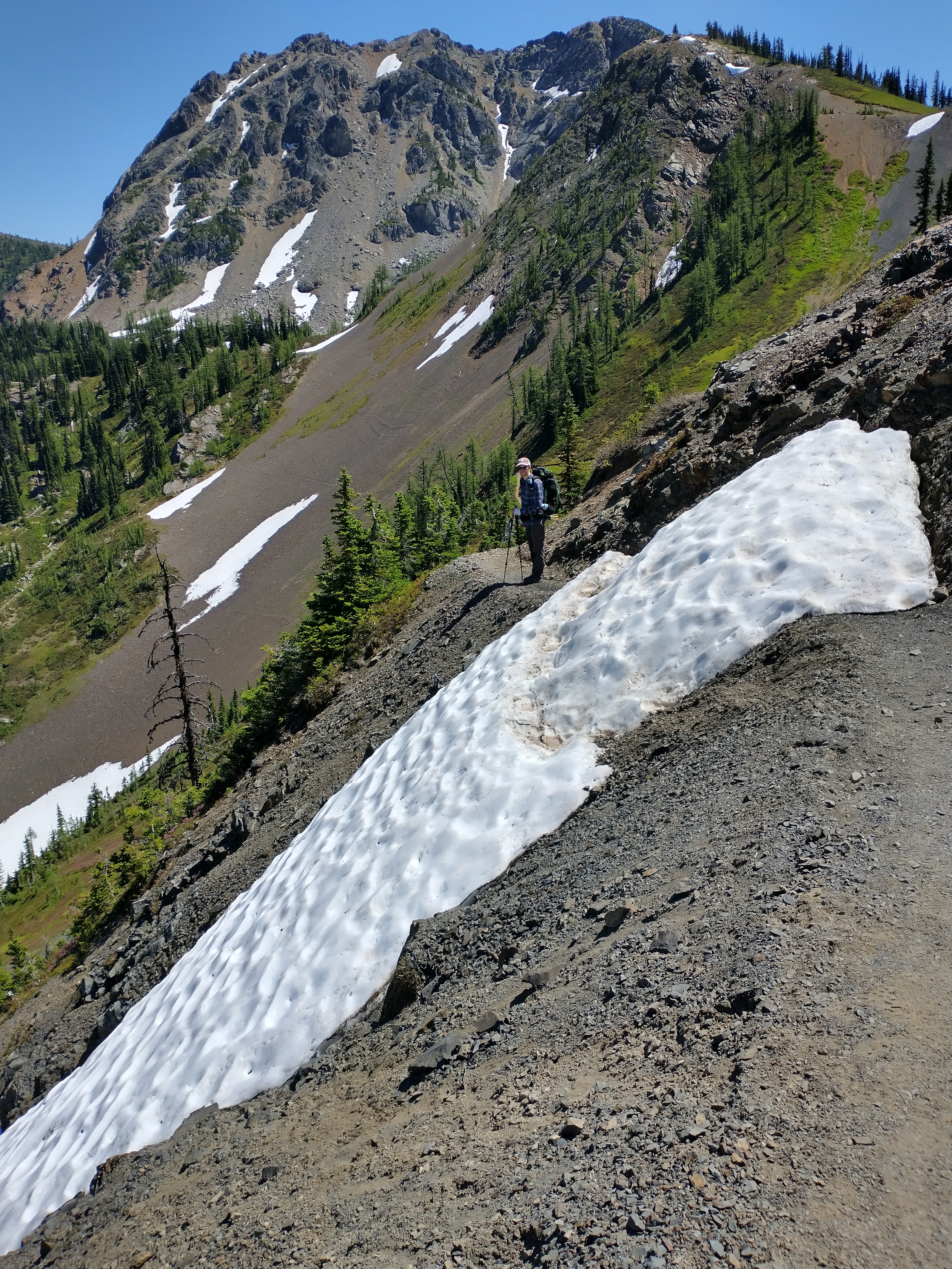
I felt a lot better today and vowed to pay more attention to my electrolyte consumption. Today was filled with lots of climbs. It was interesting going back the way we came and seeing what had changed. A lot of snow had melted in just two days. We made muesli at the “viewpoint” about 1 mile away from camp. (Not sure why they needed to label a viewpoint on the map when literally this entire section was a viewpoint.) With good food in our bellies, we found that the climb up back up Rock Pass wasn’t that bad, since we were doing it earlier in the day so it wasn’t too hot.
Since we knew our campsite would be buggy, we cooked lunch on top of Rock Pass. The meal was the oddly named “Chainsaw’s Pumpkin Pleaser.” It was the meal I was most worried about – and for good reason. I ate half of it and got a huge stomachache. For some reason I kept on eating, and my stomach felt worse and worse. I had Tim finish the rest. I took a Pepto Bismol which eventually helped, but my stomach was roiling for the next hour. I’m glad we tested that meal out before putting it in our resupplies!
As we were eating lunch, we saw our friend from Castle Pass campsite again. She had a story to tell. There was one other hiker at the campsite with her last night, and he was a hammock camper. He was terrified of mountain goats, and he got so scared that he asked our friend if she could sleep in her tent. She, being a more trusting and generous person than I, graciously allowed him to do so. So two adult strangers shared a 1-person tent overnight. She didn’t sleep at all that night, but it made for a great story. Moral of the story: If you can’t handle the wildlife, bring a tent.
We made it back to the same camp as our first night on trail, feeling tired but reasonably so. All in all I feel pretty good about our mileage. We’re making sure we don’t get injured by starting off slow. So far we’re not too sore and we don’t have any blisters. Fingers crossed it stays that way!
Normally at this stage of a backpacking trip, I’m dreaming of burgers and beds and returning to civilization. But now I feel like I could stay out here forever (modulo being dirty. I really need to take a shower and wash my clothes). I think this is a good sign. It’s also probably because this is the longest backpacking trip I’ve done where we’ve had good weather the whole time (see https://wanderliz.blog/2019/09/19/the-wonderland-trail/ for fun times in the rain). Moreover, our food is way better. I feel like I’ve been eating really well and don’t miss vegetables. I’m glad I spent all that time dehydrating meals.
I fell asleep almost instantly tonight. I started feeling super tired at 7:30pm, and I think I actually fell asleep at 8pm.
Most hiker trash thing I did today: Brush my teeth in the tent since I was too lazy to get out and I didn’t want to face the bugs.
Day 5: Going Home
- Start Mile: 2633.5
- End Mile: 2623.7
- Total Mileage: 9.8
I slept surprisingly well last night for being in the backcountry. Maybe I’m finally getting the hang of sleeping outdoors. I did wake up a couple of times, but for the times I was asleep, I slept deeply and maybe even dreamed. There were a bunch of goats or deer who were hanging around camp and every time I woke up I could hear their little hooves. One of them just stood next to the tent breathing until I smacked the tent and it got scared and ran away. Goats are weird…
There was nothing exceptional to note on the way back, except an encounter with a coronavirus skeptic who disparaged our masks and told us we were “more likely to get the virus through our eyes and ears.” Totally makes sense (sarcasm, in case it wasn’t obvious). We got back to the car in the early afternoon, feeling triumphant and happy. When we got there, we met a fellow hike whose car wouldn’t start. We tried to jump their car but couldn’t get close enough due to the giant rocks all over the road. Finally, someone in a Jeep passed by and jumped their car using our jumper cables. It really made me wish I had a bigger car.
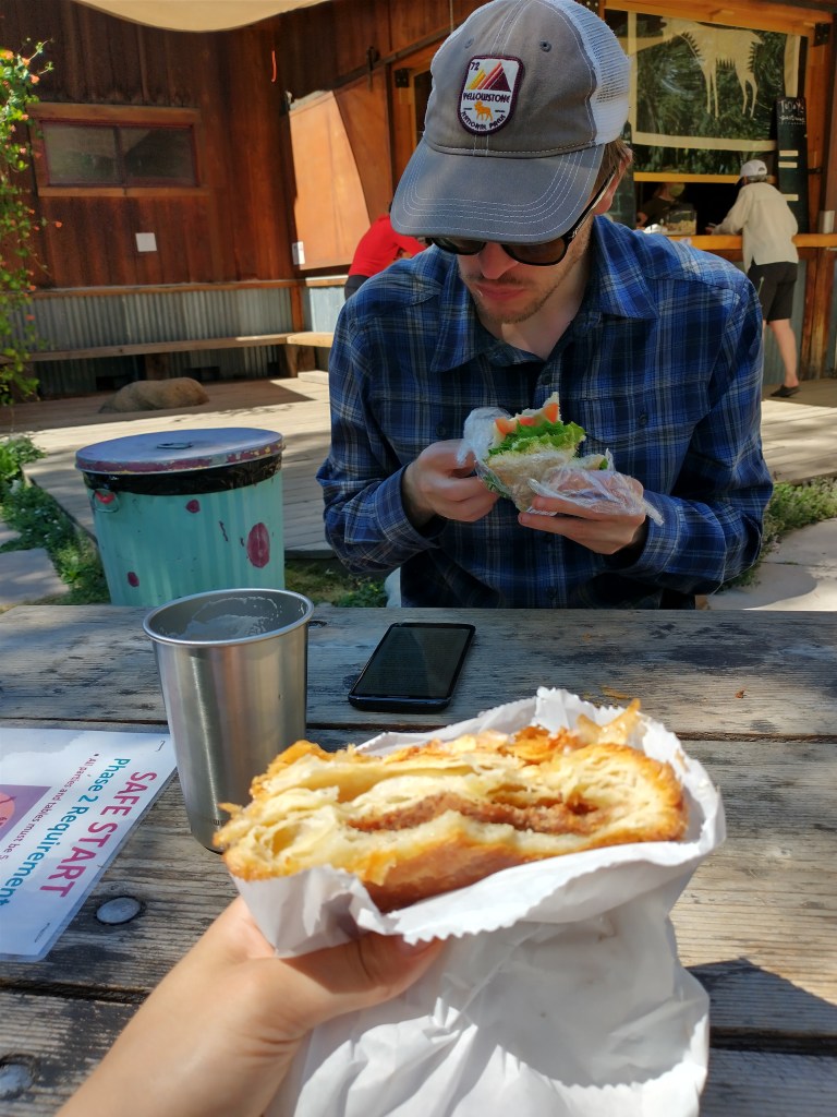
We made a pit stop in Mazama for some local beer, sandwiches, and pastries (served outdoors at socially distanced picnic tables). It was absolutely delightful and gave us fuel for the long drive home. Now to rest, repack, mail supplies, clean gear, and prepare for the next part of our journey.