
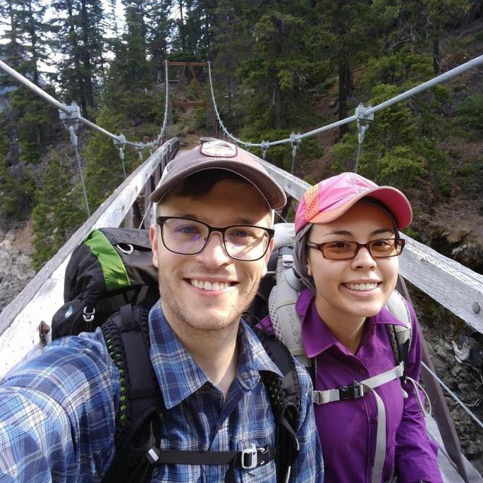
This was our first backpacking trip of the season. We had a prior commitment on Saturday of Memorial Day weekend, so we only had Sunday and Monday to backpack. The trip we ended up taking was not at all what we intended. Originally, we planned to hike the Chelan Lakeshore Trail to Stehekin, which is a 17.5 mile trip that involves taking a ferry. I called a week before our trip, and the lady working there just laughed at me when I said that I wanted to book a ferry for Memorial Day weekend. Apparently you need to book these things quite far in advance!
We wanted to avoid snow, so we considered other low elevation hikes in Olympic National Park and North Cascades National Park. I didn’t like the idea of worrying about the tides for the beach hikes in Olympic National Park. I did some more research and found that the trails near Ross Lake are low elevation and generally snow free. Thunder Creek seemed to have the best views, so we decided to go from the Thunder Creek trailhead to Junction camp, a round-trip distance of about 19 miles. Permits are first-come first-served (unless you reserve far in advance), and there are a limited number of allowed campsites, so we planned to arrive early.
However, when we rolled up to the ranger station at 8am on Sunday morning, our plans changed. The ranger, who was a no-nonsense, kindly fellow, told us that there was literally one backcountry campsite in the entire park available for Sunday night: the Lodgepole campsite along the Ross Lake East Bank Trail. The ranger estimated it was about 32 miles round-trip. Welp, guess we’re doing that one!
Luckily, the ranger had overestimated the distance. According to my Garmin watch, our total round-trip distance was 30.4 miles from the East Bank Trailhead to Lodgepole (not including a 0.2 mile detour to Rainbow Point). This was still the longest backpacking trip I had ever done, in terms of both total and daily mileage, so I was a bit nervous. I didn’t even know what the elevation profile was like, but I assumed it was fairly mild since it followed a lake. I was sort of right in that regard – the trail has a total elevation gain of 3111 feet on the way there and 3292 feet on the way back.

We finally started our hike at 10am after accidentally passing the trailhead on Highway 20 and having to double back. The first 6 or so miles involve cresting a large hill to get to the lake. You walk uphill for 3-4 miles in a forest, after which the trail levels out and starts going downhill. During this uphill walk, we were buffeted with wafts of warm air carrying the most heavenly fresh pine smell. There were quite a few small creek crossings where you might accidentally get your toes wet. At around mile 6.5 you cross Roland Creek, which is a slightly larger creek crossing (the water went slightly above my ankles). After the Enchantments, I no longer fear small creek crossings or getting my feet wet.
At the creek crossing, we ran into a woman who gave us a water filter and asked us to give it to a couple of hikers who were headed in the same direction as us. They had accidentally dropped this filter in the creek while crossing. Apparently this group consisted of a woman with medium length hair, a man with a shaved head, and a pug. This begged the obvious questions: Who on earth brings a pug on a backpacking trip? Were they carrying it? What was going on? We took the water filter and agreed to complete this mission to the best of our abilities.
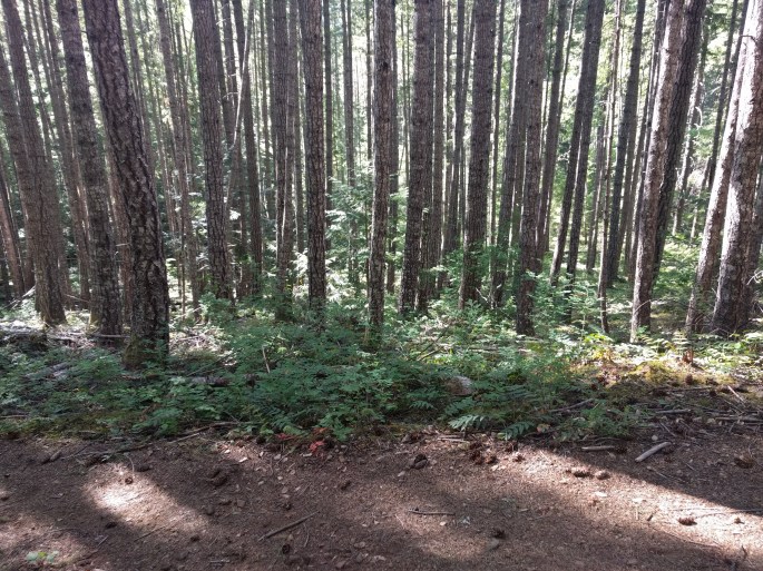
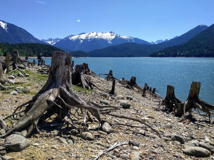
The trail conditions were perfect and everything was dry and warm, though the trail was a bit of an obstacle course as there were a lot of downed trees. Tim and I played the “should we go over or under?” game ad nauseum. Around mile 7 or 8, we started getting tantalizing glimpses of the lake and snow-capped peaks through the dense trees. We stopped for lunch at Rainbow Point, which is a campsite on the lake located 8.8 miles from the trailhead. We asked some fellow campers about our pug friends and learned that they had already passed this way. We received confirmation that the pug was in fact hiking on its own and not being carried. Pugs are tiny and have trouble breathing even when stationary. How was this pug hiking so far?
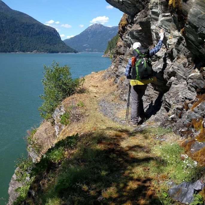
We continued on to my favorite part of the hike. After a mile or two of following the lake, you enter a beautiful rocky cliff section. We ran into more hikers and inquired about the pug situation. Apparently the pug people were still ahead of us. We were being outhiked by a pug!
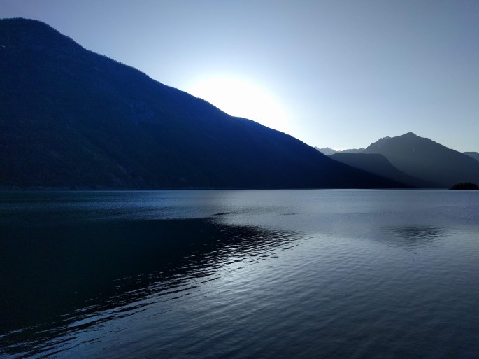
The cliffs lasted for a short while, then the trail reentered the forest. At Devil’s Junction (a campsite and junction at mile 13.5) we finally encountered a member of the pug group and were able to give them the water filter. He was so grateful. Alas, we never got to meet the wonder-pug. I was so impressed that this pug hiked 13.5 miles, almost faster than we did. We made it to Lodgepole at 6pm, which is on the water and amazingly beautiful. We watched the sunset and fell asleep (or tried to) by 9pm.
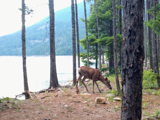
We woke up at 5am to the sounds of curious deer sniffing around the camp. We broke camp and headed out at 6:20am to get an early start. We were pretty sore and tired. After we passed Rainbow Point, I began to cycle through the five stages of exhaustion: denial, anger, bargaining, depression, and acceptance. I was thrilled when we reached the trailhead at 1:30pm. We had hiked 30.8 miles in 27.5 hours! We got some well-deserved burgers at Red Robin in Burlington and headed home.
Aside: I have to say that this was my most glamorous backpacking trip so far. All of the campsites had enclosed outhouses (not just open pit toilets), bear boxes, picnic tables, and fire pits. There was plentiful toilet paper in the Lodgepole outhouse, which was quite surprising. I only had to pee in the woods twice! Most of the trail was in the forest, so breathtaking views only occurred at certain viewpoints. This wasn’t a problem for us; the forest was beautiful and pleasant. I would definitely recommend this trail as an early season hike. If you want to make it a longer trip, the trail continues almost to the Canadian border, a one-way distance of 32 miles.
